
File:Rio Magdalena Delta landsat.jpg
Size of this preview: 653 × 599 pixels. Other resolutions: 262 × 240 pixels | 523 × 480 pixels | 837 × 768 pixels | 1,096 × 1,006 pixels.
Original file (1,096 × 1,006 pixels, file size: 557 KB, MIME type: image/jpeg)
| This is a file from the Wikimedia Commons. Information from its description page there is shown below. Commons is a freely licensed media file repository. You can help. |
Summary
| Description |
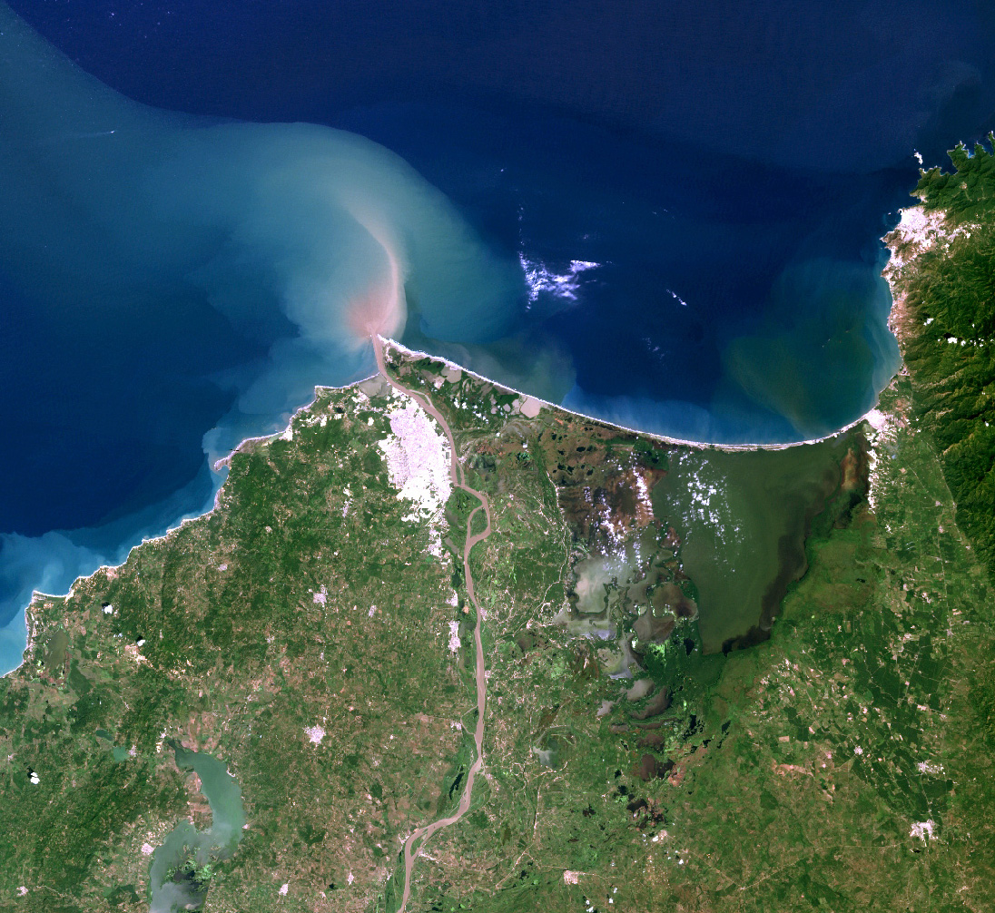
English: Landsat7 image of the Magdalena River delta. |
| Date | |
| Source |
Source for this data set was the Global Land Cover Facility, www.landcover.org
|
| Author | Alexrk2 |
| Permission (Reusing this file) |
Use is free to all; effectively held by USGS & NASA; but ultimately held by US public. |
Licensing
| This file is in the public domain in the United States because it was solely created by NASA. NASA copyright policy states that "NASA material is not protected by copyright unless noted". (See Template:PD-USGov, NASA copyright policy page or JPL Image Use Policy.) | ||
 |
Warnings:
|
File history
Click on a date/time to view the file as it appeared at that time.
| Date/Time | Thumbnail | Dimensions | User | Comment | |
|---|---|---|---|---|---|
| current | 16:14, 9 February 2010 | | 1,096 × 1,006 (557 KB) | Alexrk2 | {{Information |Description={{en|Landsat7 image of the Magdalena River delta.}} |Source=Source for this data set was the Global Land Cover Facility, www.landcover.org * Acquisition date: 2000-11-25, Sensor: ETM+, Bands: 1,2,3 |Date=2 |
File usage
The following pages on the English Wikipedia use this file (pages on other projects are not listed):
Global file usage
The following other wikis use this file:
- Usage on af.wikipedia.org
- Usage on ast.wikipedia.org
- Usage on avk.wikipedia.org
- Usage on azb.wikipedia.org
- Usage on bh.wikipedia.org
- Usage on de.wikipedia.org
- Usage on el.wikipedia.org
- Usage on es.wikipedia.org
- Usage on fa.wikipedia.org
- Usage on fr.wikipedia.org
- Usage on id.wikipedia.org
- Usage on io.wikipedia.org
- Usage on ja.wikipedia.org
- Usage on ka.wikipedia.org
- Usage on la.wikipedia.org
- Usage on nl.wikipedia.org
- Usage on nn.wikipedia.org
- Usage on simple.wikipedia.org
- Usage on sl.wikipedia.org
- Usage on sw.wikipedia.org
- Usage on ta.wikipedia.org
- Usage on tr.wikipedia.org
- Usage on vi.wikipedia.org
- Usage on war.wikipedia.org
- Usage on xmf.wikipedia.org