
File:Riccartoun map 1880.jpg

Size of this preview: 794 × 600 pixels. Other resolutions: 318 × 240 pixels | 636 × 480 pixels | 1,017 × 768 pixels | 1,280 × 967 pixels | 2,560 × 1,933 pixels | 3,920 × 2,960 pixels.
Original file (3,920 × 2,960 pixels, file size: 2.51 MB, MIME type: image/jpeg)
Summary[edit]
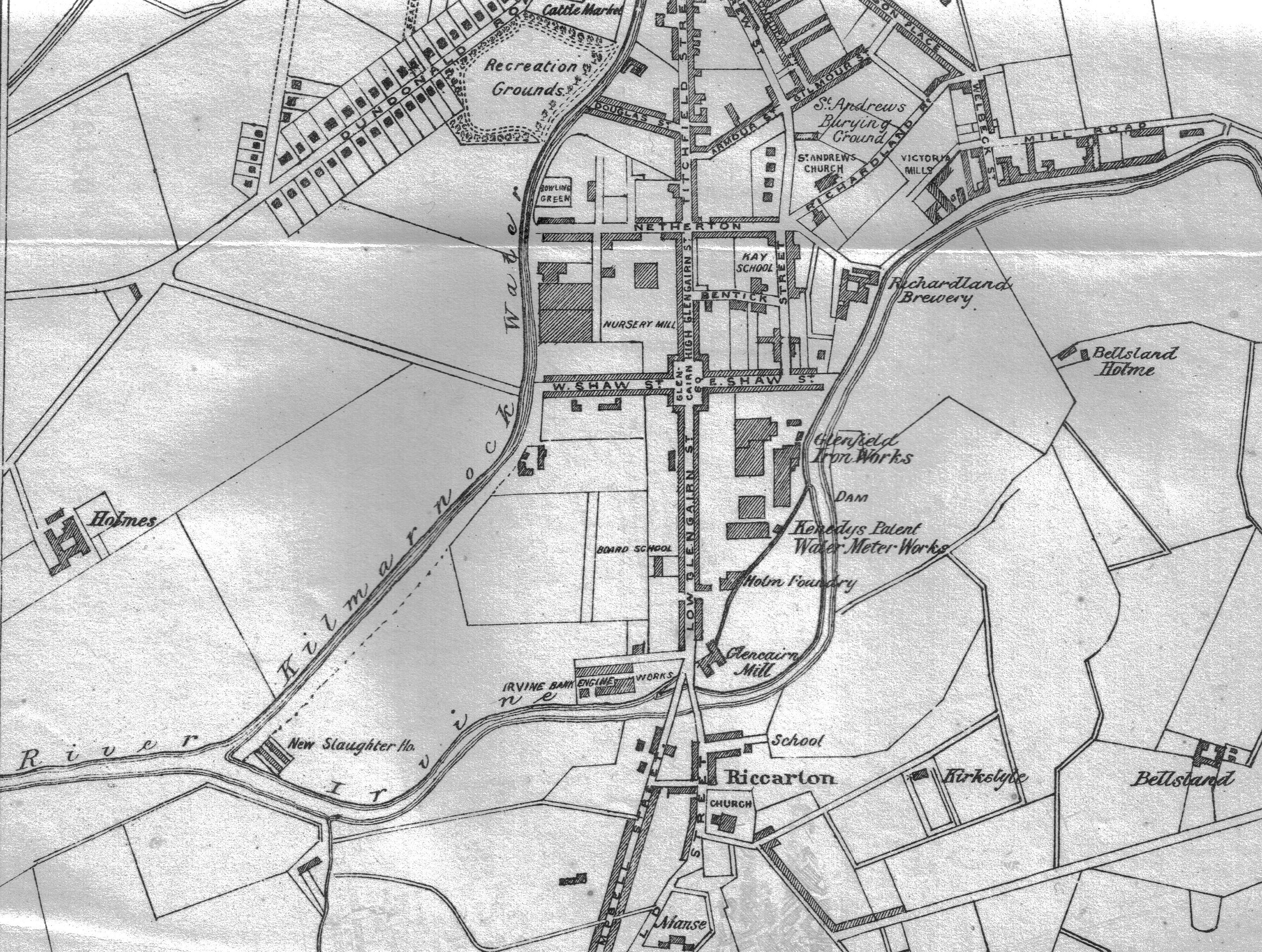
| Description | East Ayrshire, Scotland.
Riccartoun Map. A part of Kilmarnock also shown. |
|---|---|
| Source |
McKay, Archibald (1880). The History of Kilmarnock. Pub. A. McKay, Kilmarnock. Following page 357. |
| Date |
1880 |
| Author |
Rosser1954 - Roger Griffith |
| Permission (Reusing this file) |
See below.
|
Licensing:[edit]
| This image is in the public domain because under the Copyright law of the United States, originality of expression is necessary for copyright protection, and a mere photograph of an out-of-copyright two-dimensional work may not be protected under American copyright law. The official position of the Wikimedia Foundation is that all reproductions of public domain works should be considered to be in the public domain regardless of their country of origin (even in countries where mere labor is enough to make a reproduction eligible for protection). | ||||
| ||||
 | This file is a candidate to be copied to Wikimedia Commons.
Any user may perform this transfer; refer to Wikipedia:Moving files to Commons for details. If this file has problems with attribution, copyright, or is otherwise ineligible for Commons, then remove this tag and DO NOT transfer it; repeat violators may be blocked from editing. Other Instructions
| ||
| |||
File history
Click on a date/time to view the file as it appeared at that time.
| Date/Time | Thumbnail | Dimensions | User | Comment | |
|---|---|---|---|---|---|
| current | 14:42, 16 March 2008 | | 3,920 × 2,960 (2.51 MB) | Rosser1954 (talk | contribs) | {{Information |Description=Riccartoun Map. A part of Kilmarnock also shown. |Source= McKay, Archibald (1880). The History of Kilmarnock. Pub. A. McKay, Kilmarnock. Following page 357. |Date= 1880 |Location= East Ayrshire, Scotland. |Author= Rosser1954 - R |
You cannot overwrite this file.
File usage
The following pages on the English Wikipedia use this file (pages on other projects are not listed):