
File:Planisphæri cœleste.jpg
Size of this preview: 800 × 547 pixels. Other resolutions: 320 × 219 pixels | 640 × 437 pixels | 1,024 × 700 pixels | 1,280 × 875 pixels | 2,560 × 1,750 pixels | 5,812 × 3,972 pixels.
Original file (5,812 × 3,972 pixels, file size: 19.07 MB, MIME type: image/jpeg)
| This is a file from the Wikimedia Commons. Information from its description page there is shown below. Commons is a freely licensed media file repository. You can help. |
Summary
| Author |
|
|||||||||||||||||||||||||
| Description |
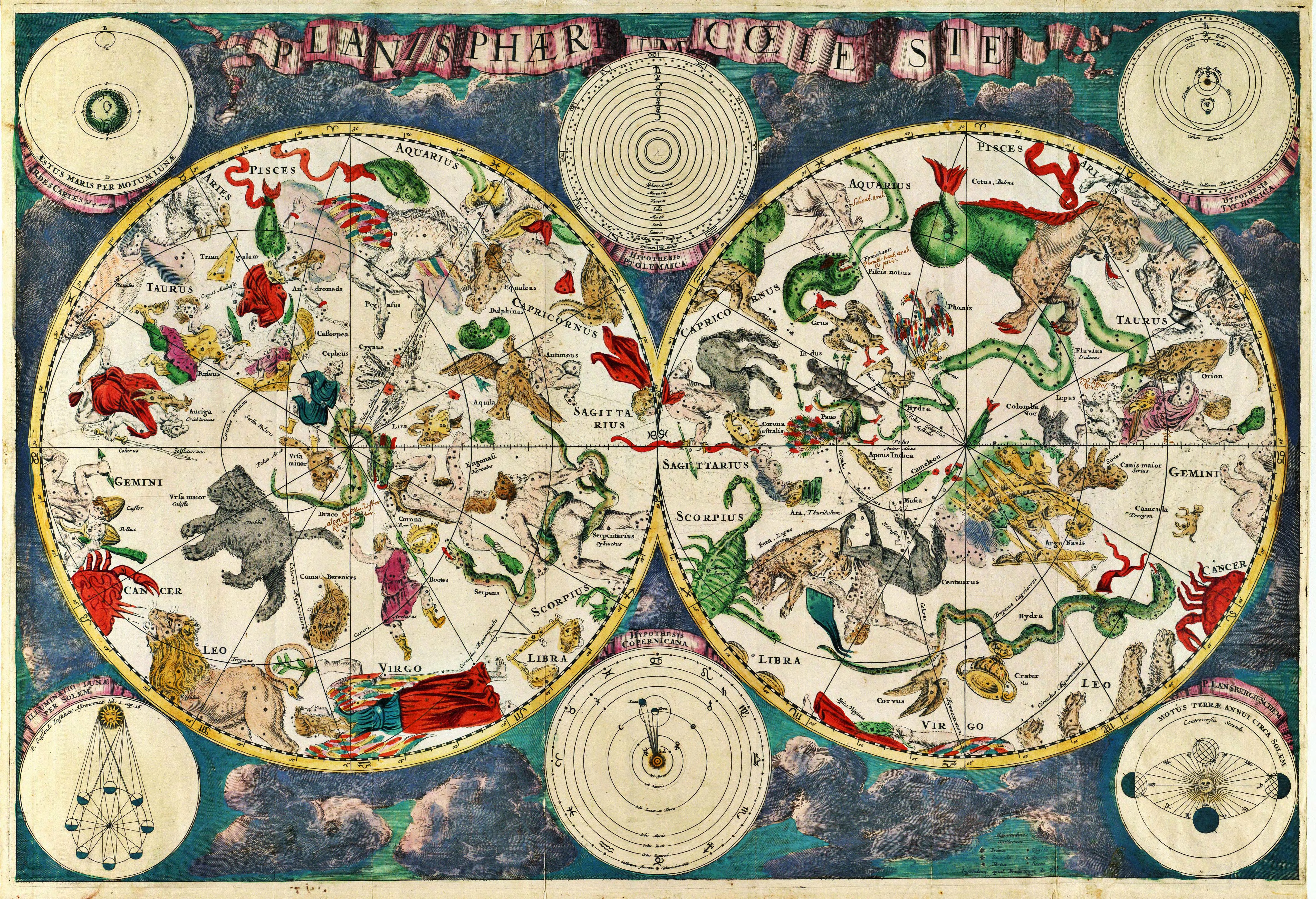
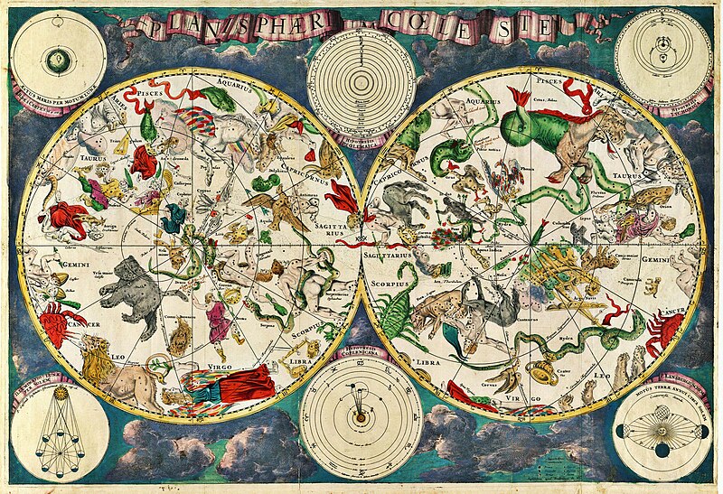
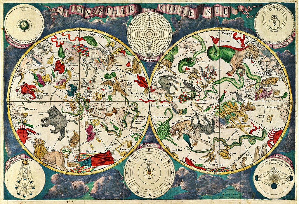
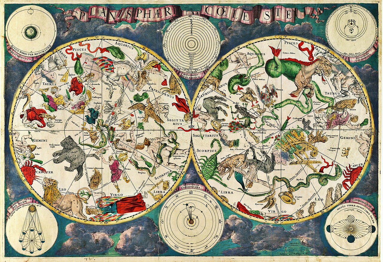
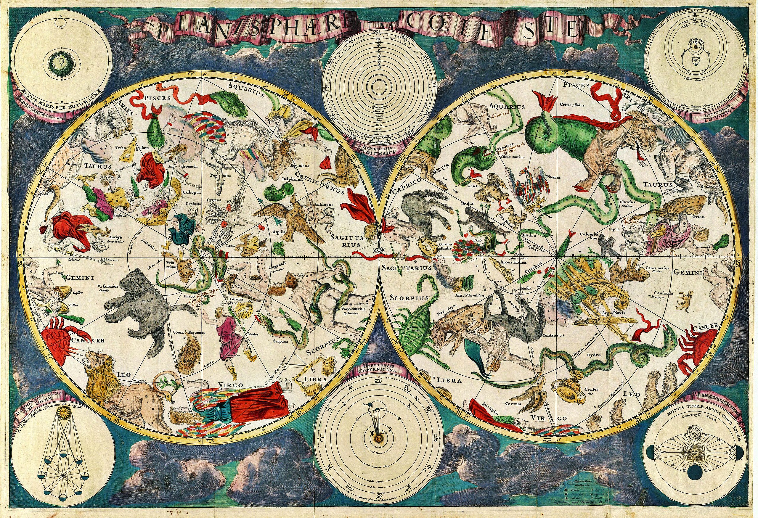
Planisphærium cœleste, denmark, Frederik V English: Celestial map Français : Carte céleste |
|||||||||||||||||||||||||
| Date | 1670 | |||||||||||||||||||||||||
| References | Koninklijke Deense Bibliotheek | |||||||||||||||||||||||||
| Source/Photographer | Transferred from en.wikipedia to Commons. Scanned by Janke | |||||||||||||||||||||||||
Original upload log
The original description page was here. All following user names refer to en.wikipedia.
- 2007-03-10 18:20 Janke 1804×1236×8 (3237455 bytes) Celestial map from the 17th century, by the Dutch cartographer Frederik de Wit. Scanned by uploader
Licensing
|
This is a faithful photographic reproduction of a two-dimensional, public domain work of art. The work of art itself is in the public domain for the following reason:
The official position taken by the Wikimedia Foundation is that "faithful reproductions of two-dimensional public domain works of art are public domain".
This photographic reproduction is therefore also considered to be in the public domain in the United States. In other jurisdictions, re-use of this content may be restricted; see Reuse of PD-Art photographs for details. | ||||
File history
Click on a date/time to view the file as it appeared at that time.
| Date/Time | Thumbnail | Dimensions | User | Comment | |
|---|---|---|---|---|---|
| current | 10:01, 23 December 2010 | | 5,812 × 3,972 (19.07 MB) | Joopr | Hogere resolutie |
| 00:18, 29 May 2007 |  | 1,804 × 1,236 (3.09 MB) | STyx | {{Information |Description= {{la}}Planisphæri cœleste {{en}}Celestial map from the 17th century, by the Dutch cartographer Frederik de Wit. {{fr}}Carte céleste du XVII ème siècle, réalisée par le cartographe hollandais Frederik de Wit. {{du}}[http |
File usage
The following pages on the English Wikipedia use this file (pages on other projects are not listed):
- Astronomy
- Constellation
- Map
- Natural philosophy
- Star chart
- Talk:Astronomy/Archive 2
- User:Sj/olpc dictionary images/500
- Wikipedia:Featured picture candidates/17th century star map
- Wikipedia:Featured picture candidates/March-2007
- Wikipedia:Wikipedia Signpost/2013-01-14/WikiProject report
- Wikipedia:Wikipedia Signpost/Single/2013-01-14
- Portal:Maps/Maps/Historical
- Portal:Maps/Maps/Historical/7
Global file usage
The following other wikis use this file:
- Usage on ar.wikipedia.org
- Usage on ar.wikibooks.org
- Usage on ast.wikipedia.org
- Usage on az.wikipedia.org
- Usage on ba.wikipedia.org
- Usage on bg.wikipedia.org
- Usage on bn.wikipedia.org
- Usage on ca.wikipedia.org
- Usage on cbk-zam.wikipedia.org
- Usage on ce.wikipedia.org
- Usage on cs.wikipedia.org
- Usage on de.wikipedia.org
- Usage on el.wikipedia.org
- Usage on en.wikiquote.org
- Usage on eo.wikipedia.org
- Usage on es.wikipedia.org
- Usage on fi.wikipedia.org
- Usage on fr.wikipedia.org
- Usage on gl.wikipedia.org
- Usage on gu.wikipedia.org
- Usage on he.wikipedia.org
- Usage on hi.wikipedia.org
- Usage on hr.wikipedia.org
- Usage on hy.wikipedia.org
- Usage on hyw.wikipedia.org
- Usage on id.wikipedia.org
View more global usage of this file.