
File:Patterson-viaduct.jpg

Size of this preview: 763 × 599 pixels. Other resolutions: 306 × 240 pixels | 611 × 480 pixels | 978 × 768 pixels | 1,280 × 1,006 pixels | 2,560 × 2,011 pixels | 4,684 × 3,680 pixels.
Original file (4,684 × 3,680 pixels, file size: 3.58 MB, MIME type: image/jpeg)
| This is a file from the Wikimedia Commons. Information from its description page there is shown below. Commons is a freely licensed media file repository. You can help. |
Summary
| Description |
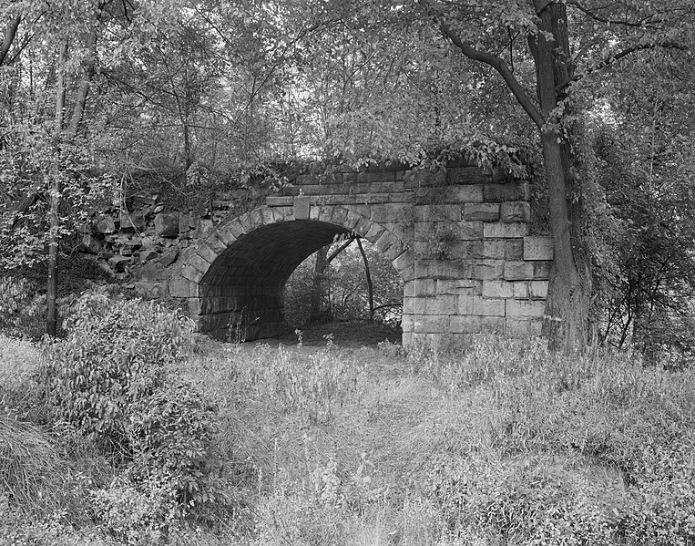
English: Patterson Viaduct near Ilchester, Maryland, view of west abutment looking north, showing common road arch. Cropped image.
|
||
| Date | |||
| Source |
Historic American Engineering Record; Library of Congress HAER MD,3-____,6
|
||
| Author | William E. Barrett | ||
| Other versions |
 |

| Object location | | View this and other nearby images on: OpenStreetMap |
|---|
Licensing
| This image or media file contains material based on a work of a National Park Service employee, created as part of that person's official duties. As a work of the U.S. federal government, such work is in the public domain in the United States. See the NPS website and NPS copyright policy for more information. |
|
Original upload log
The original description page was here. All following user names refer to en.wikipedia.
- 2006-04-05 18:34 Eoghanacht 460×442× (63130 bytes) [[Patterson Viaduct]] near [[Ilchester, Maryland]], view of west abutment looking north, showing common road arch. Approximate location: {{coor dms|39|14|56|N|76|45|53|W|}}. Cropt from [[Historic American Engineering Record]] photograph by [[William E.
File history
Click on a date/time to view the file as it appeared at that time.
| Date/Time | Thumbnail | Dimensions | User | Comment | |
|---|---|---|---|---|---|
| current | 05:37, 30 March 2009 | | 4,684 × 3,680 (3.58 MB) | Martin H. | High res; cropped |
| 20:44, 29 March 2009 |  | 460 × 442 (62 KB) | File Upload Bot (Magnus Manske) | {{BotMoveToCommons|en.wikipedia|year={{subst:CURRENTYEAR}}|month={{subst:CURRENTMONTHNAME}}|day={{subst:CURRENTDAY}}}} {{Information |Description={{en|en:Patterson Viaduct near en:Ilchester, Maryland, view of west abutment looking north, showin |
File usage
The following pages on the English Wikipedia use this file (pages on other projects are not listed):
Global file usage
The following other wikis use this file:
- Usage on ar.wikipedia.org
- Usage on www.wikidata.org