
File:Old railway halt - geograph.org.uk - 526183.jpg
No higher resolution available.
Old_railway_halt_-_geograph.org.uk_-_526183.jpg (640 × 480 pixels, file size: 86 KB, MIME type: image/jpeg)
| This is a file from the Wikimedia Commons. Information from its description page there is shown below. Commons is a freely licensed media file repository. You can help. |
Summary
| Description |
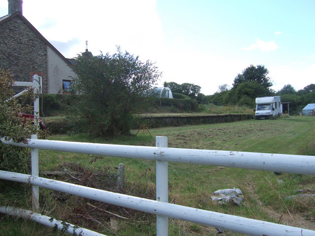
English: Old railway halt This is all that remains of the halt at Glogue. It appears to have been incorporated into a private garden but the old platform is clearly visible.
The Whitland & Taf Vale Railway was incorporated on 1 July 1869 to extend its line to Crymych. The Engineer was James Weekes Szlumper of Aberystwyth. The line opened to Glogue on 24 March 1873 and to Crymych in October 1874; in both cases for freight. Passenger services had to wait until 12 July 1875. The line was closed in 1962. |
| Date | |
| Source | From geograph.org.uk |
| Author | ceridwen |
| Attribution (required by the license) | ceridwen / Old railway halt / |
| Camera location | | View this and other nearby images on: OpenStreetMap |
|---|
_heading:270.00&language=en)
| Object location | | View this and other nearby images on: OpenStreetMap |
|---|
_heading:270.00&language=en)
Licensing

|
This image was taken from the Geograph project collection. See this photograph's page on the Geograph website for the photographer's contact details. The copyright on this image is owned by ceridwen and is licensed for reuse under the Creative Commons Attribution-ShareAlike 2.0 license.
|
This file is licensed under the Creative Commons Attribution-Share Alike 2.0 Generic license.
Attribution: ceridwen
- You are free:
- to share – to copy, distribute and transmit the work
- to remix – to adapt the work
- Under the following conditions:
- attribution – You must give appropriate credit, provide a link to the license, and indicate if changes were made. You may do so in any reasonable manner, but not in any way that suggests the licensor endorses you or your use.
- share alike – If you remix, transform, or build upon the material, you must distribute your contributions under the same or compatible license as the original.
File history
Click on a date/time to view the file as it appeared at that time.
| Date/Time | Thumbnail | Dimensions | User | Comment | |
|---|---|---|---|---|---|
| current | 16:58, 5 February 2011 | | 640 × 480 (86 KB) | GeographBot | == {{int:filedesc}} == {{Information |description={{en|1=Old railway halt This is all that remains of the halt at Glogue. It appears to have been incorporated into a private garden but the old platform is clearly visible. The Whitland & Taf Vale Railwa |
File usage
The following pages on the English Wikipedia use this file (pages on other projects are not listed):
Global file usage
The following other wikis use this file:
- Usage on cy.wikipedia.org
- Usage on www.wikidata.org