
File:Northumbria 802.jpg

Size of this preview: 486 × 599 pixels. Other resolutions: 195 × 240 pixels | 389 × 480 pixels | 623 × 768 pixels | 831 × 1,024 pixels | 1,800 × 2,218 pixels.
Original file (1,800 × 2,218 pixels, file size: 649 KB, MIME type: image/jpeg)
| This is a file from the Wikimedia Commons. Information from its description page there is shown below. Commons is a freely licensed media file repository. You can help. |
Summary
| Description |
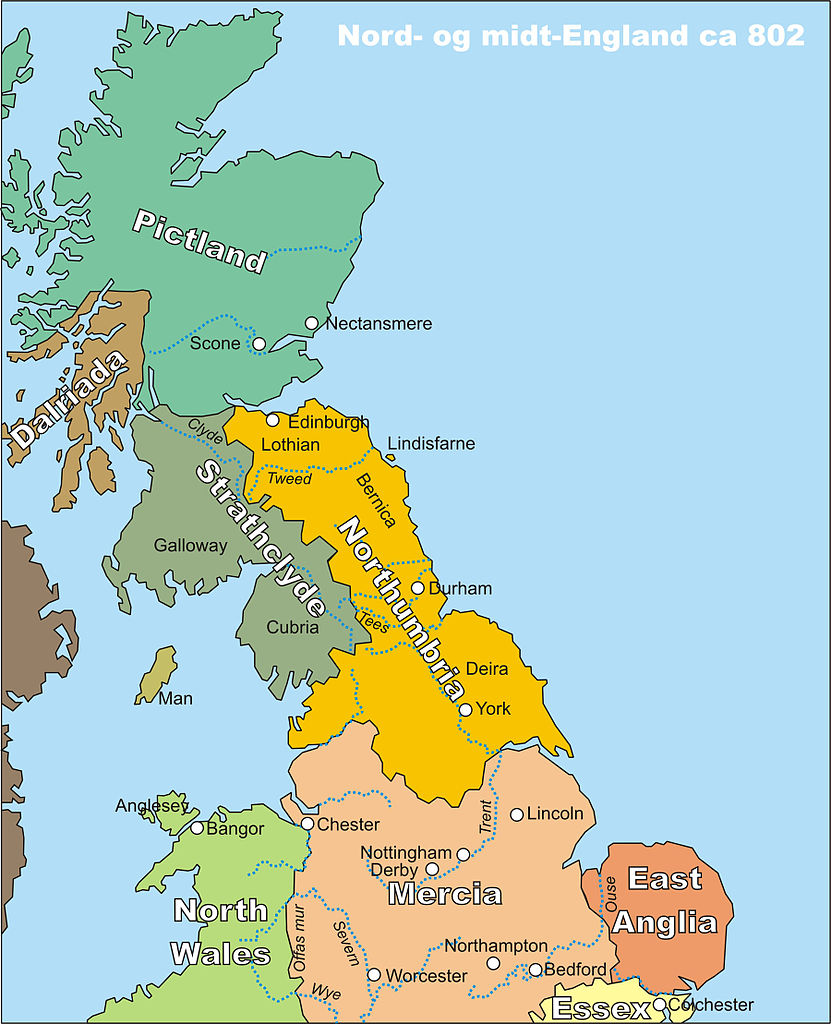
Norsk bokmål: Kart over midt- og nord-England, spesielt Northumbria, rundt år 802
English: Map of middle and northern England, centred around Northumbria, circa 802 |
| Date | |
| Source | My own drawing, drawn in CorelDraw12, source file available on request, or in different file formats |
| Author | Finn (the uploader) |
| Permission (Reusing this file) |
PD |
Licensing
| I, the copyright holder of this work, release this work into the public domain. This applies worldwide. In some countries this may not be legally possible; if so: I grant anyone the right to use this work for any purpose, without any conditions, unless such conditions are required by law. |
File history
Click on a date/time to view the file as it appeared at that time.
| Date/Time | Thumbnail | Dimensions | User | Comment | |
|---|---|---|---|---|---|
| current | 21:22, 19 October 2006 | | 1,800 × 2,218 (649 KB) | Finn Bjorklid | == Summary == {{Information |Description=Kart over midt- og nord-England, spesielt Northumbria, rundt år 802 (Map of Middle and Northern England, spc. Northumbria, around 802) |Source=My own drawing, drawn in CorelDraw12, source file available on request |
File usage
The following pages on the English Wikipedia use this file (pages on other projects are not listed):
Global file usage
The following other wikis use this file:
- Usage on br.wikipedia.org
- Usage on da.wikipedia.org
- Usage on de.wikipedia.org
- Usage on eo.wikipedia.org
- Usage on fr.wikipedia.org
- Usage on fr.wiktionary.org
- Usage on fy.wikipedia.org
- Usage on hr.wikipedia.org
- Usage on lv.wikipedia.org
- Usage on nl.wikipedia.org
- Usage on no.wikipedia.org
- Usage on pt.wikipedia.org
- Usage on th.wikipedia.org