
File:Near Church Farm, Barnsley - geograph.org.uk - 805929.jpg
No higher resolution available.
Near_Church_Farm,_Barnsley_-_geograph.org.uk_-_805929.jpg (640 × 395 pixels, file size: 122 KB, MIME type: image/jpeg)
| This is a file from the Wikimedia Commons. Information from its description page there is shown below. Commons is a freely licensed media file repository. You can help. |
Summary
| Description |
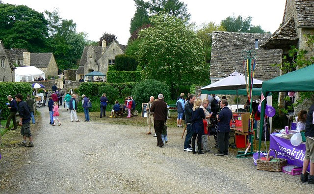
English: Near Church Farm, Barnsley The view shows part of the farmyard of Church Farm, in the heart of the Gloucestershire village on the day of Barsnley Village Festival. Normally private gardens were open to the public and there were small stalls selling food, drinks, books, garden plants and herbs. |
| Date | |
| Source | From geograph.org.uk |
| Author | Brian Robert Marshall |
| Attribution (required by the license) | Brian Robert Marshall / Near Church Farm, Barnsley / |
| Camera location | | View this and other nearby images on: OpenStreetMap |
|---|
_heading:292.00&language=en)
| Object location | | View this and other nearby images on: OpenStreetMap |
|---|
_heading:292.00&language=en)
Licensing

|
This image was taken from the Geograph project collection. See this photograph's page on the Geograph website for the photographer's contact details. The copyright on this image is owned by Brian Robert Marshall and is licensed for reuse under the Creative Commons Attribution-ShareAlike 2.0 license.
|
This file is licensed under the Creative Commons Attribution-Share Alike 2.0 Generic license.
Attribution: Brian Robert Marshall
- You are free:
- to share – to copy, distribute and transmit the work
- to remix – to adapt the work
- Under the following conditions:
- attribution – You must give appropriate credit, provide a link to the license, and indicate if changes were made. You may do so in any reasonable manner, but not in any way that suggests the licensor endorses you or your use.
- share alike – If you remix, transform, or build upon the material, you must distribute your contributions under the same or compatible license as the original.

|
The categories of this image need checking. You can do so here.
|
File history
Click on a date/time to view the file as it appeared at that time.
| Date/Time | Thumbnail | Dimensions | User | Comment | |
|---|---|---|---|---|---|
| current | 08:59, 20 February 2011 | | 640 × 395 (122 KB) | GeographBot | == {{int:filedesc}} == {{Information |description={{en|1=Near Church Farm, Barnsley The view shows part of the farmyard of Church Farm, in the heart of the Gloucestershire village on the day of Barsnley Village Festival. Normally private gardens were open |
File usage
The following pages on the English Wikipedia use this file (pages on other projects are not listed):