
File:Napa River Napa-Sonoma Marsh.jpg

Size of this preview: 800 × 534 pixels. Other resolutions: 320 × 214 pixels | 640 × 427 pixels | 1,024 × 683 pixels | 1,500 × 1,001 pixels.
Original file (1,500 × 1,001 pixels, file size: 469 KB, MIME type: image/jpeg)
| This is a file from the Wikimedia Commons. Information from its description page there is shown below. Commons is a freely licensed media file repository. You can help. |
| Description |
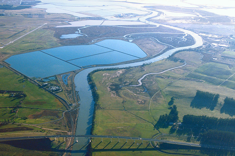
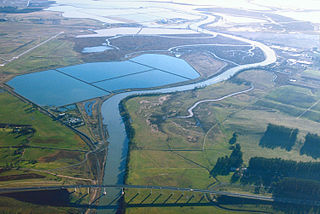
English: Aerial view of the southern end of the Napa River in Napa County, California, USA. The river empties into Napa-Sonoma Marsh (top) and then into San Pablo Bay at the northern end of San Francisco Bay. Most of this picture is located in Napa County. At the extreme top edge of the picture is the border with Solano County. View is to the south.
Coordinates: 38°13′28.91″N 122°17′45.7″W / 38.2246972°N 122.296028°W |
|||
| Location | Napa County, Califiornia, USA | |||
| Date | not specified or unknown | |||
| Source |
U.S. Army Corps of Engineers Digital Visual Library Image page Image description page Digital Visual Library home page |
|||
| Author | U.S. Army Corps of Engineers, photographer not specified or unknown | |||
| Permission (Reusing this file) |
|
|||
| Other versions |
.jpg)
File history
Click on a date/time to view the file as it appeared at that time.
| Date/Time | Thumbnail | Dimensions | User | Comment | |
|---|---|---|---|---|---|
| current | 02:53, 4 May 2007 | | 1,500 × 1,001 (469 KB) | DanMS | {{Information | Description = {{en|Aerial view of the southern end of the Napa River in Napa County, California, USA. The river empties into Napa-Sonoma Marsh (top) and then into San Pablo Bay at the northern end of San Francisco Bay. Most of this pict |
File usage
The following pages on the English Wikipedia use this file (pages on other projects are not listed):
Global file usage
The following other wikis use this file:
- Usage on de.wikipedia.org
- Usage on fr.wikipedia.org
- Usage on it.wikipedia.org
- Usage on ja.wikipedia.org
- Usage on nl.wikipedia.org
- Usage on ru.wikipedia.org
- Usage on www.wikidata.org