
File:Nacotchtank Location on John Smith's 1624 Map of Virginia.jpg

Size of this preview: 800 × 355 pixels. Other resolutions: 320 × 142 pixels | 1,029 × 456 pixels.
Original file (1,029 × 456 pixels, file size: 154 KB, MIME type: image/jpeg)
| This is a file from the Wikimedia Commons. Information from its description page there is shown below. Commons is a freely licensed media file repository. You can help. |
Summary
| Description |
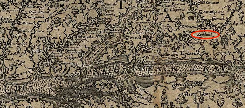
English: Zoomed in version of John Smith's 1624 Map of Virginia with a red circle to indicate the location of the Nacotchtank tribe, as indicated by Smith. |
| Date | |
| Source | Own work |
| Author | Peterpietri |
Licensing
This work is in the public domain in the United States because it was published (or registered with the U.S. Copyright Office) before January 1, 1929.
|
File history
Click on a date/time to view the file as it appeared at that time.
| Date/Time | Thumbnail | Dimensions | User | Comment | |
|---|---|---|---|---|---|
| current | 20:54, 8 November 2020 | | 1,029 × 456 (154 KB) | Peterpietri | Cross-wiki upload from en.wikipedia.org |
File usage
The following pages on the English Wikipedia use this file (pages on other projects are not listed):