
File:Mullet Key detail.png
No higher resolution available.
Mullet_Key_detail.png (477 × 409 pixels, file size: 200 KB, MIME type: image/png)
| This is a file from the Wikimedia Commons. Information from its description page there is shown below. Commons is a freely licensed media file repository. You can help. |
Summary
| Description |
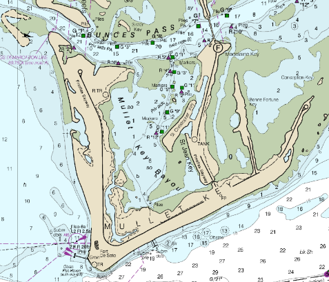
English: The chart shows the shape of Mullet Key, a barrier island. The image is of a part of the File:Mullet Key chart.pdf. |
| Date | |
| Source |
https://www.charts.noaa.gov/BookletChart/11415_BookletChart.pdf Detail from BookletChart: Tampa Bay Entrance, NOAA Chart 11415 |
| Author | NOAA's Office of Coast Survey |
Licensing
This image is in the public domain because it contains materials that originally came from the U.S. National Oceanic and Atmospheric Administration, taken or made as part of an employee's official duties.
|
File history
Click on a date/time to view the file as it appeared at that time.
| Date/Time | Thumbnail | Dimensions | User | Comment | |
|---|---|---|---|---|---|
| current | 19:45, 15 July 2023 | | 477 × 409 (200 KB) | Donald Albury | Uploaded a work by NOAA's Office of Coast Survey from https://www.charts.noaa.gov/BookletChart/11415_BookletChart.pdf Detail from BookletChart: Tampa Bay Entrance, NOAA Chart 11415 with UploadWizard |
File usage
The following pages on the English Wikipedia use this file (pages on other projects are not listed):