
File:Mt. Tammany Trail Map.webp

Size of this PNG preview of this WEBP file: 800 × 499 pixels. Other resolutions: 320 × 199 pixels | 640 × 399 pixels | 1,152 × 718 pixels.
Original file (1,152 × 718 pixels, file size: 95 KB, MIME type: image/webp)
| This is a file from the Wikimedia Commons. Information from its description page there is shown below. Commons is a freely licensed media file repository. You can help. |
Summary
| Description |
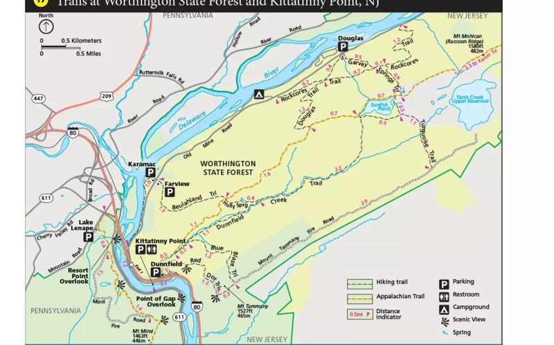
English: Trails at Mt. Tammany near Kittatinny Point, NJ |
| Date | |
| Source | https://www.nps.gov/dewa/planyourvisit/red-dot-trail.htm |
| Author | US NPS |
Licensing
| This image or media file contains material based on a work of a National Park Service employee, created as part of that person's official duties. As a work of the U.S. federal government, such work is in the public domain in the United States. See the NPS website and NPS copyright policy for more information. |
File history
Click on a date/time to view the file as it appeared at that time.
| Date/Time | Thumbnail | Dimensions | User | Comment | |
|---|---|---|---|---|---|
| current | 01:03, 21 June 2022 | | 1,152 × 718 (95 KB) | Lindsey40186 | Uploaded a work by US NPS from https://www.nps.gov/dewa/planyourvisit/red-dot-trail.htm with UploadWizard |
File usage
The following pages on the English Wikipedia use this file (pages on other projects are not listed):