
File:Map of maryland counties Baltimore,AA,Somerset (4th RGT).PNG
Size of this preview: 800 × 429 pixels. Other resolutions: 320 × 171 pixels | 814 × 436 pixels.
Original file (814 × 436 pixels, file size: 145 KB, MIME type: image/png)
| This is a file from the Wikimedia Commons. Information from its description page there is shown below. Commons is a freely licensed media file repository. You can help. |
.PNG)
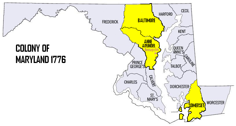
| Description | Map of the Colony of Maryland 1776, 4th Maryland Regiment's Recruitment Areas |
| Date | |
| Source | edited by Oldwildbill |
| Author | Oldwildbill |
| Permission (Reusing this file) |
David Benbennick – created Maryland Map for free use. |
| This work has been released into the public domain by its author, Dbenbenn. This applies worldwide. In some countries this may not be legally possible; if so: Dbenbenn grants anyone the right to use this work for any purpose, without any conditions, unless such conditions are required by law.
|
This work is based on a work in the public domain. It has been digitally enhanced and/or modified. This derivative work has been (or is hereby) released into the public domain by its author, Oldwildbill. This applies worldwide.
In some countries this may not be legally possible; if so: |
File history
Click on a date/time to view the file as it appeared at that time.
| Date/Time | Thumbnail | Dimensions | User | Comment | |
|---|---|---|---|---|---|
| current | 07:47, 11 June 2006 | | 814 × 436 (145 KB) | Oldwildbill~commonswiki | {{Information |Description=Map of the Colony of Maryland 1776, 4th Maryland Regiment's Recruitment Areas |Source= edited by Oldwildbill |Date=11 June 2006 |Author=Oldwildbill |P |
File usage
The following pages on the English Wikipedia use this file (pages on other projects are not listed):
Global file usage
The following other wikis use this file:
- Usage on www.wikidata.org
.PNG)