
File:MapOfTutuila-American-Samoa.png

Size of this preview: 800 × 519 pixels. Other resolutions: 320 × 208 pixels | 640 × 415 pixels | 1,024 × 664 pixels | 1,280 × 831 pixels | 3,033 × 1,968 pixels.
Original file (3,033 × 1,968 pixels, file size: 338 KB, MIME type: image/png)
| This is a file from the Wikimedia Commons. Information from its description page there is shown below. Commons is a freely licensed media file repository. You can help. |
Summary
| Description |
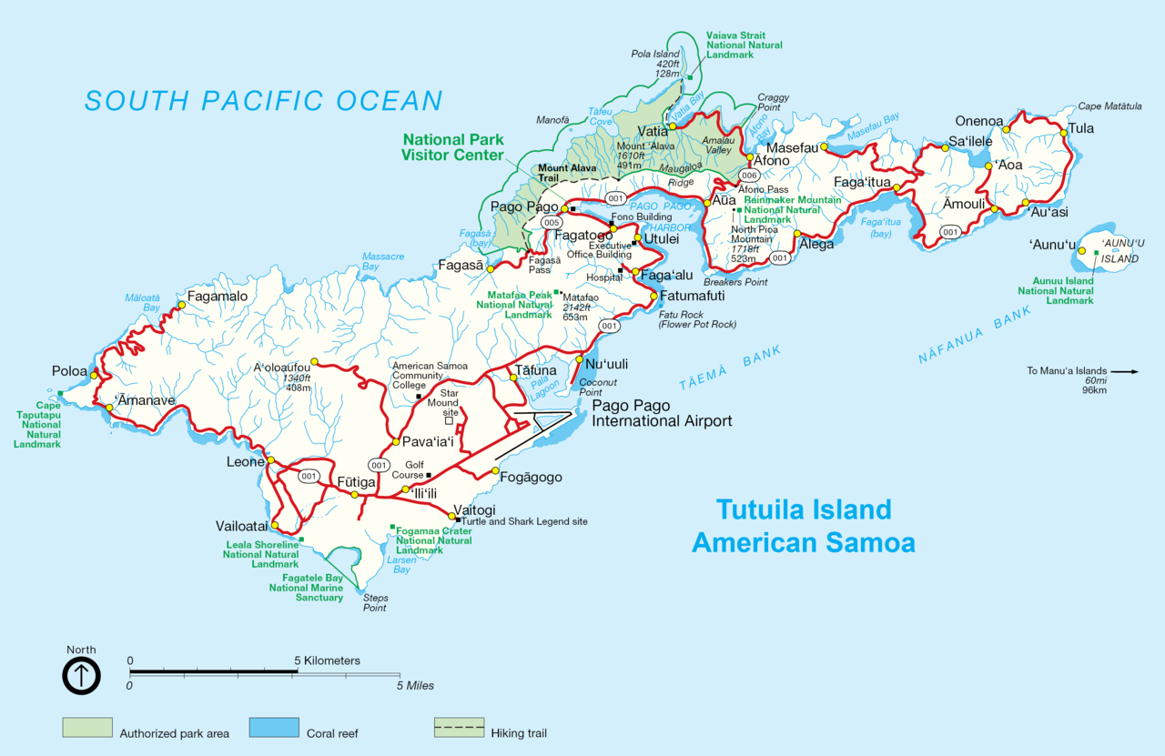
English: NPS map of Tutuila, American Samoa |
| Date | circa 2002 |
| Source | http://www.nps.gov/archive/npsa/pdf/tutuila.pdf, modified and converted into .png |
| Author | NPS, modified by Durin, converted by Telim tor |
| Other versions | Original .gif version |
Licensing
| This image or media file contains material based on a work of a National Park Service employee, created as part of that person's official duties. As a work of the U.S. federal government, such work is in the public domain in the United States. See the NPS website and NPS copyright policy for more information. |
| This work was previously under Public Domain, or a Free License. It has been digitally enhanced and/or modified. This derivative work has been (or is hereby) released into the public domain by its author, Telim tor at the German Wikipedia project. This applies worldwide. In some countries this is not legally possible; if so:
|
File history
Click on a date/time to view the file as it appeared at that time.
| Date/Time | Thumbnail | Dimensions | User | Comment | |
|---|---|---|---|---|---|
| current | 10:08, 3 October 2009 | | 3,033 × 1,968 (338 KB) | Telim tor | == {{int:filedesc}} == {{Information |Description={{en|NPS map of Tutuila, Anerican Samoa}} |Source=http://www.nps.gov/archive/npsa/pdf/tutuila.pdf, modified and converted into .png |Date=ca. 2002 |Author=NPS, modified by Durin, converted |
File usage
No pages on the English Wikipedia use this file (pages on other projects are not listed).
Global file usage
The following other wikis use this file:
- Usage on az.wikipedia.org
- Usage on cy.wikipedia.org
- Usage on de.wikipedia.org
- Usage on pl.wikipedia.org
- Usage on tr.wikipedia.org