
File:Loch eck bathymetry.png

Size of this preview: 800 × 377 pixels. Other resolutions: 320 × 151 pixels | 640 × 302 pixels | 1,024 × 483 pixels | 1,920 × 905 pixels.
Original file (1,920 × 905 pixels, file size: 1.1 MB, MIME type: image/png)
| This is a file from the Wikimedia Commons. Information from its description page there is shown below. Commons is a freely licensed media file repository. You can help. |
Summary
| Description |
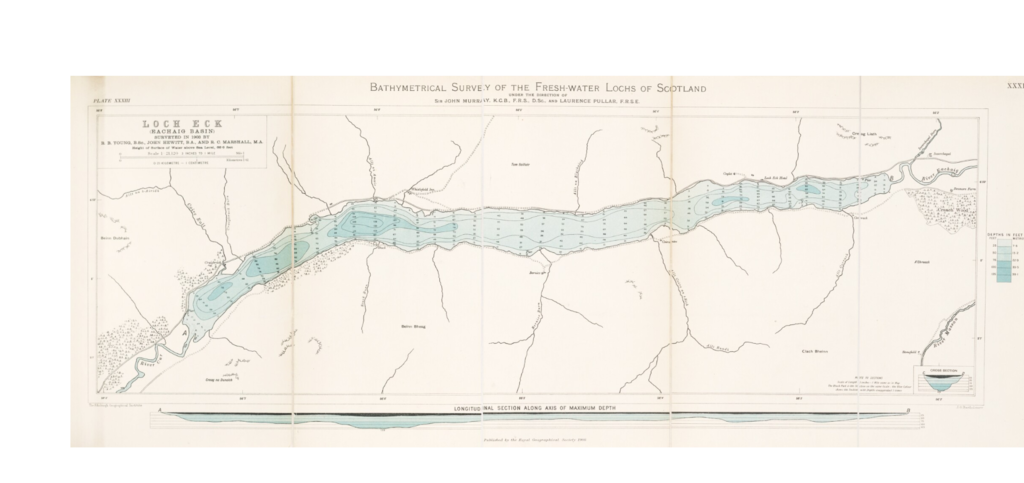
English: Loch Eck (Vol 5 Plate 33) from the Bathymetrical Survey of Fresh-Water Lochs, 1897-1909 |
| Date | |
| Source | https://maps.nls.uk/view/74422317 |
| Author | Murray, Sir John and Pullar, Laurence |
| Object location | | View this and other nearby images on: OpenStreetMap |
|---|
Licensing
This file is licensed under the Creative Commons Attribution-Share Alike 4.0 International license.
- You are free:
- to share – to copy, distribute and transmit the work
- to remix – to adapt the work
- Under the following conditions:
- attribution – You must give appropriate credit, provide a link to the license, and indicate if changes were made. You may do so in any reasonable manner, but not in any way that suggests the licensor endorses you or your use.
- share alike – If you remix, transform, or build upon the material, you must distribute your contributions under the same or compatible license as the original.
File history
Click on a date/time to view the file as it appeared at that time.
| Date/Time | Thumbnail | Dimensions | User | Comment | |
|---|---|---|---|---|---|
| current | 04:57, 29 December 2018 | | 1,920 × 905 (1.1 MB) | Rsjaffe | {{Information |description ={{en|1=Loch Eck (Vol 5 Plate 33) from the Bathymetrical Survey of Fresh-Water Lochs, 1897-1909}} |date =1910 |source =https://maps.nls.uk/view/74422317 |author =Murray, Sir John and Pullar, Laurence }} {{Object location|56.084823|-4.995354}} |
File usage
The following pages on the English Wikipedia use this file (pages on other projects are not listed):