
File:Leeds Rail.svg

Size of this PNG preview of this SVG file: 800 × 412 pixels. Other resolutions: 320 × 165 pixels | 640 × 330 pixels | 1,024 × 528 pixels | 1,280 × 660 pixels | 2,560 × 1,319 pixels | 1,145 × 590 pixels.
Original file (SVG file, nominally 1,145 × 590 pixels, file size: 818 KB)
| This is a file from the Wikimedia Commons. Information from its description page there is shown below. Commons is a freely licensed media file repository. You can help. |
| Description |
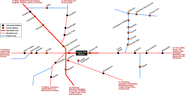
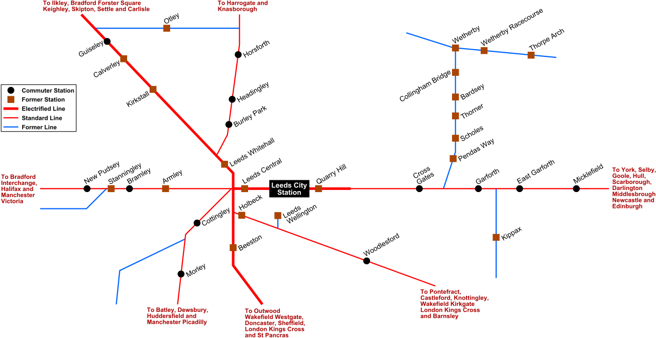
English: Map of current and former rail networks in Leeds |
| Date | |
| Source | Unknown source |
| Author | The original uploader was Mtaylor848 at English Wikipedia. |
Licensing
This file is licensed under the Creative Commons Attribution-Share Alike 3.0 Unported license.
- You are free:
- to share – to copy, distribute and transmit the work
- to remix – to adapt the work
- Under the following conditions:
- attribution – You must give appropriate credit, provide a link to the license, and indicate if changes were made. You may do so in any reasonable manner, but not in any way that suggests the licensor endorses you or your use.
- share alike – If you remix, transform, or build upon the material, you must distribute your contributions under the same or compatible license as the original.

|
Permission is granted to copy, distribute and/or modify this document under the terms of the GNU Free Documentation License, Version 1.2 or any later version published by the Free Software Foundation; with no Invariant Sections, no Front-Cover Texts, and no Back-Cover Texts. A copy of the license is included in the section entitled GNU Free Documentation License. |
File history
Click on a date/time to view the file as it appeared at that time.
| Date/Time | Thumbnail | Dimensions | User | Comment | |
|---|---|---|---|---|---|
| current | 21:17, 27 June 2009 | | 1,145 × 590 (818 KB) | AxG | Fix |
| 21:15, 27 June 2009 |  | 1,145 × 590 (802 KB) | AxG | Fix | |
| 21:14, 27 June 2009 |  | 1,145 × 590 (663 KB) | AxG | Fix | |
| 21:11, 27 June 2009 |  | 1,145 × 590 (128 KB) | AxG | Fix | |
| 21:07, 27 June 2009 |  | 1,145 × 590 (438 KB) | AxG | Update | |
| 11:34, 10 June 2009 |  | 1,145 × 590 (68 KB) | AxG | Add | |
| 16:52, 10 May 2009 |  | 1,145 × 590 (68 KB) | AxG | {{Information |Description={{en|Map of current and former rail networks in Leeds}} |Source=Unknown |Date=10 April 2009 |Author=AxG (talk). Original uploader was Mtaylor848 at [http://en.wikipe |
File usage
The following pages on the English Wikipedia use this file (pages on other projects are not listed):
Global file usage
The following other wikis use this file:
- Usage on pl.wikipedia.org