
File:Le comté de Nice et Oneille.jpg

Size of this preview: 800 × 495 pixels. Other resolutions: 320 × 198 pixels | 640 × 396 pixels | 1,024 × 634 pixels | 1,280 × 792 pixels | 2,362 × 1,462 pixels.
Original file (2,362 × 1,462 pixels, file size: 341 KB, MIME type: image/jpeg)
| This is a file from the Wikimedia Commons. Information from its description page there is shown below. Commons is a freely licensed media file repository. You can help. |
Summary
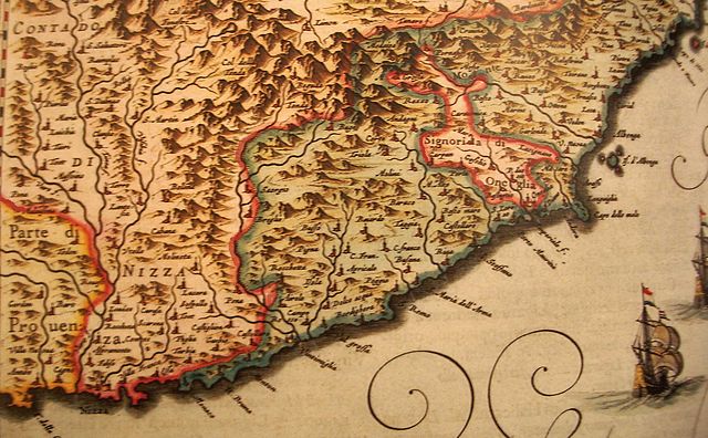
| Description |
Français : Les territoires maritimes de la Maison de Savoie: Le Comté de Nice et Oneille représentés dans l'Atlas Maior de Joan Blaeu en 1664. |
||||||||||||||||||||||||||
| Date | |||||||||||||||||||||||||||
| Source | Atlas Maior de Joan Blaeu; | ||||||||||||||||||||||||||
| Author |
|
||||||||||||||||||||||||||
.jpg)
Licensing
|
This work is in the public domain in its country of origin and other countries and areas where the copyright term is the author's life plus 100 years or fewer. This work is in the public domain in the United States because it was published (or registered with the U.S. Copyright Office) before January 1, 1929. | |
| This file has been identified as being free of known restrictions under copyright law, including all related and neighboring rights. | |
File history
Click on a date/time to view the file as it appeared at that time.
| Date/Time | Thumbnail | Dimensions | User | Comment | |
|---|---|---|---|---|---|
| current | 08:59, 5 November 2007 | | 2,362 × 1,462 (341 KB) | Pto | {{Information |Description=Les territoires maritimes des états de Savoie |Source=travail personnel |Date=Novembre 2007 |Author= Pto }} [Category:Liguria [Category:Maps of Nice]] |
File usage
The following pages on the English Wikipedia use this file (pages on other projects are not listed):
Global file usage
The following other wikis use this file:
- Usage on azb.wikipedia.org
- Usage on eo.wikipedia.org
- Usage on fr.wikipedia.org
- Usage on id.wikipedia.org
- Usage on io.wikipedia.org
- Usage on it.wikipedia.org
- Usage on lij.wikipedia.org
- Usage on pt.wikipedia.org
- Usage on sr.wikipedia.org
- Usage on vi.wikipedia.org