
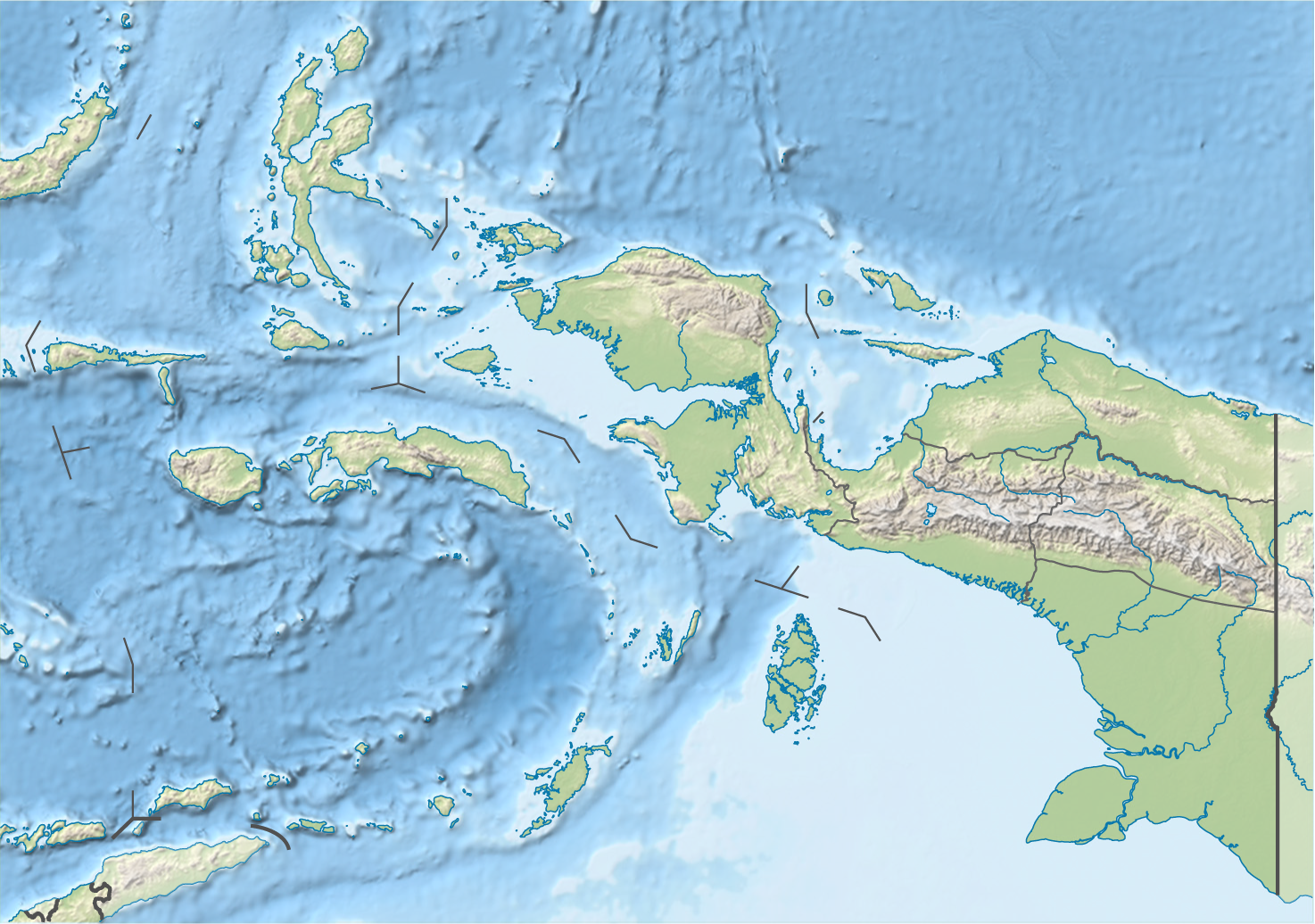
File:Indonesia Maluku-Western New Guinea topography location map.png
Size of this preview: 800 × 562 pixels. Other resolutions: 320 × 225 pixels | 640 × 450 pixels | 1,024 × 720 pixels | 1,280 × 900 pixels | 1,474 × 1,036 pixels.
Original file (1,474 × 1,036 pixels, file size: 1.87 MB, MIME type: image/png)
| This is a file from the Wikimedia Commons. Information from its description page there is shown below. Commons is a freely licensed media file repository. You can help. |
Summary
| Description |
Quadratische Plattkarte. Geographische Begrenzung der Karte:
Equirectangular projection. Geographic limits of the map:
|
|||
| Date | ||||
| Source |
Own work, using
|
|||
| Author | NordNordWest | |||
| Permission (Reusing this file) |
This file is licensed under the Creative Commons Attribution-Share Alike 3.0 Germany license.
 This file is licensed under the Creative Commons Attribution-Share Alike 3.0 Germany license.
|
|||
| Other versions |
|


|
This map has been made or improved in the German Kartenwerkstatt (Map Lab). You can propose maps to improve as well.
|
File history
Click on a date/time to view the file as it appeared at that time.
| Date/Time | Thumbnail | Dimensions | User | Comment | |
|---|---|---|---|---|---|
| current | 14:45, 22 October 2022 | | 1,474 × 1,036 (1.87 MB) | Afrogindahood | Addition of new provinces in Western New Guinea |
| 16:42, 19 December 2019 |  | 1,472 × 1,033 (1.88 MB) | Exogalaxy | {{subst:Upload marker added by en.wp UW}} {{Information |Description = {{en|Location map of Maluku and Western New Guinea, Indonesia}} |Source = https://de.wikipedia.org/wiki/Datei:Indonesia_Maluku-Western_New_Guinea_rel_location_map.svg |Author = NordNordWest |Permission = '''Evidence:''' The license statement can be found online at: https://de.wikipedia.org/wiki/Datei:Indonesia_Maluku-Western_New_Guinea_rel_location_map.svg }} |
File usage
The following pages on the English Wikipedia use this file (pages on other projects are not listed):