
File:IL-15 congressional district.gif
No higher resolution available.
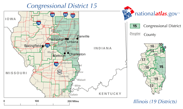
IL-15_congressional_district.gif (635 × 380 pixels, file size: 36 KB, MIME type: image/gif)
| This is a file from the Wikimedia Commons. Information from its description page there is shown below. Commons is a freely licensed media file repository. You can help. |
Map for Illinois's 15th congressional district.
Source: http://nationalatlas.gov/printable/images/preview/congdist/il15_109.gif
This map was obtained from an edition of the National Atlas of the United States. Like almost all works of the U.S. federal government, works from the National Atlas are in the public domain in the United States.
Online access: NationalAtlas.gov | 1970 print edition: Library of Congress, Perry-Castañeda Library
|
File history
Click on a date/time to view the file as it appeared at that time.
| Date/Time | Thumbnail | Dimensions | User | Comment | |
|---|---|---|---|---|---|
| current | 19:54, 26 January 2007 | | 635 × 380 (36 KB) | Dual Freq | Map for Illinois's 15th congressional district. Source: http://nationalatlas.gov/printable/images/preview/congdist/il15_109.gif {{PD-USGov-Atlas}} Category:Congressional district maps of the United States |
File usage
The following pages on the English Wikipedia use this file (pages on other projects are not listed):
Global file usage
The following other wikis use this file:
- Usage on fr.wikipedia.org