
File:Haiti OnEarth WMS.jpg

Size of this preview: 788 × 600 pixels. Other resolutions: 315 × 240 pixels | 631 × 480 pixels | 1,009 × 768 pixels | 1,280 × 974 pixels | 2,560 × 1,949 pixels | 3,719 × 2,831 pixels.
Original file (3,719 × 2,831 pixels, file size: 5.1 MB, MIME type: image/jpeg)
| This is a file from the Wikimedia Commons. Information from its description page there is shown below. Commons is a freely licensed media file repository. You can help. |
Summary
| Description |
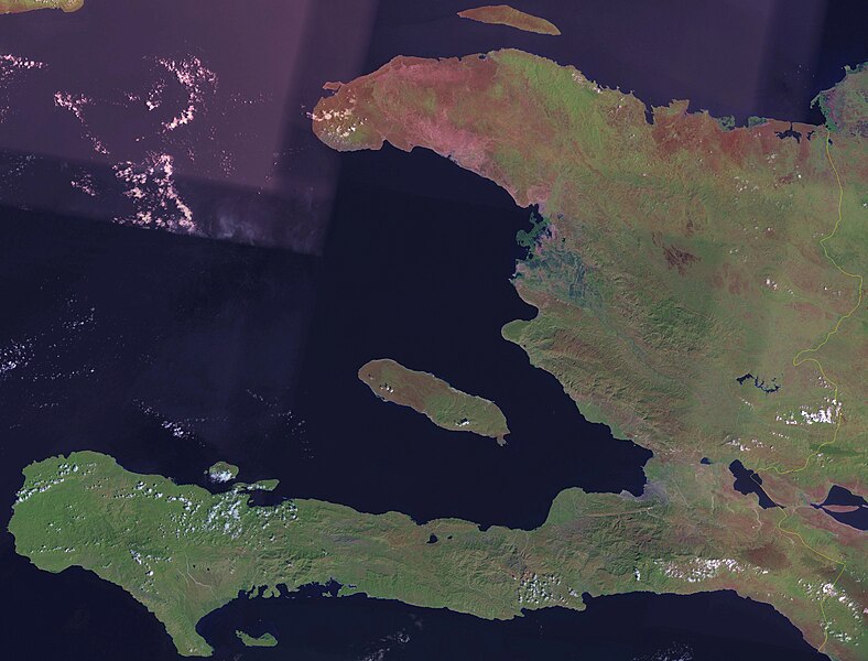
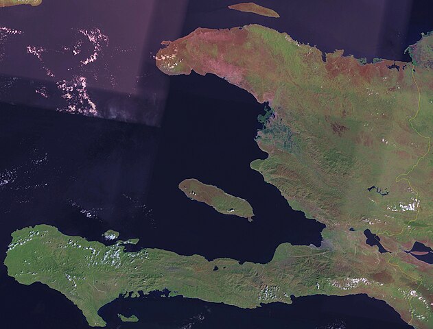
English: Satellite image of Haiti. |
| Date | circa 2006 |
| Source | Screenshot from NASA World Wind, OnEarth WMS global mosaic pseudocolor layer. |
| Author | NASA |
Licensing
| This image is in the public domain because it is a screenshot from NASA’s globe software World Wind using a public domain layer, such as Blue Marble, MODIS, Landsat, SRTM, USGS or GLOBE.
|
 |
File history
Click on a date/time to view the file as it appeared at that time.
| Date/Time | Thumbnail | Dimensions | User | Comment | |
|---|---|---|---|---|---|
| current | 18:40, 21 April 2006 | | 3,719 × 2,831 (5.1 MB) | Hautala | {{PD-WorldWind}} Satellite image of Haiti. Screenshot from NASA World Wind, OnEarth WMS layer. Category:Satellite images of countries |
File usage
The following pages on the English Wikipedia use this file (pages on other projects are not listed):
Global file usage
The following other wikis use this file:
- Usage on af.wikipedia.org
- Usage on fi.wikipedia.org
- Usage on pl.wikipedia.org
- Usage on tl.wikipedia.org
- Usage on uk.wikipedia.org