
File:Grotta di Nettuno Alghero 40.jpg

Original file (2,400 × 1,800 pixels, file size: 1.88 MB, MIME type: image/jpeg)
| This is a file from the Wikimedia Commons. Information from its description page there is shown below. Commons is a freely licensed media file repository. You can help. |
Summary
| Description |
עברית: מערת נפטון באלגרו |
| Date | |
| Source | Own work |
| Author | Daniel Ventura |
| Camera location | | View this and other nearby images on: OpenStreetMap |
|---|
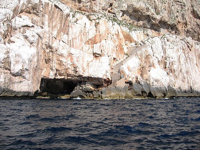
מערת נפטון (באיטלקית: Grotta di Nettuno) היא מערה השוכנת בבסיסו של קאפו קאצ'יה (Capo Caccia), מצוק העשוי מסלעי גיר ודולומיט, סמוך למפרץ פורטו קונטה בצפון-מערב סרדיניה. עקב חדירת מי גשמים נוצרו בחלל המערה נטיפים וזקיפים. בניגוד למערות נטיפים אחרות, עקב סמיכותה של המערה אל הים נוצרו בה ברכות מים מלוחים אשר מפלסן זהה למפלס פני הים. קרני האור המגיעות אל המערה מהפתחים יוצרות שילוב של מראות צבעוניים באולמות המערה בהתאם לשעות היום. אורך מסלולי המערה מגיע ל-4 ק"מ אך רק 580 מטר מהם פתוחים לקהל. הכניסה והיציאה מהמערה היא אחת ושוכנת בגובה של מטר בודד מעל פני הים. דרך כניסה זו מתאפשרת ההגעה אל המערה לבאים דרך הים ולאלה היורדים אליה דרך שביל בן 656 מדרגות לאורכן של המצוק, המכונה "אסקאלה דל קבירול" (Escala del Cabirol - "מדרגות העז"). בעת סערה אין אפשרות להגיע למערה כלל, לא דרך הים ולא דרך השביל היבשתי. המערה התגלתה במקרה על ידי דייג במאה ה-18, ובמקום התגלו שרידים קדומים של כלב ים נזירי מצוי. המדרגות היורדות מהמגדלור אל המערה נחצבו בשנת 1954.
Licensing
- You are free:
- to share – to copy, distribute and transmit the work
- to remix – to adapt the work
- Under the following conditions:
- attribution – You must give appropriate credit, provide a link to the license, and indicate if changes were made. You may do so in any reasonable manner, but not in any way that suggests the licensor endorses you or your use.
- share alike – If you remix, transform, or build upon the material, you must distribute your contributions under the same or compatible license as the original.
File history
Click on a date/time to view the file as it appeared at that time.
| Date/Time | Thumbnail | Dimensions | User | Comment | |
|---|---|---|---|---|---|
| current | 20:51, 3 February 2014 | | 2,400 × 1,800 (1.88 MB) | Daniel Ventura | User created page with UploadWizard |