
File:GOES-13 2 Jan 2014 1745z satellite.png

Size of this preview: 800 × 450 pixels. Other resolutions: 320 × 180 pixels | 640 × 360 pixels | 1,024 × 576 pixels | 1,280 × 720 pixels | 1,920 × 1,080 pixels.
Original file (1,920 × 1,080 pixels, file size: 1.1 MB, MIME type: image/png)
| This is a file from the Wikimedia Commons. Information from its description page there is shown below. Commons is a freely licensed media file repository. You can help. |
Summary
| Description |
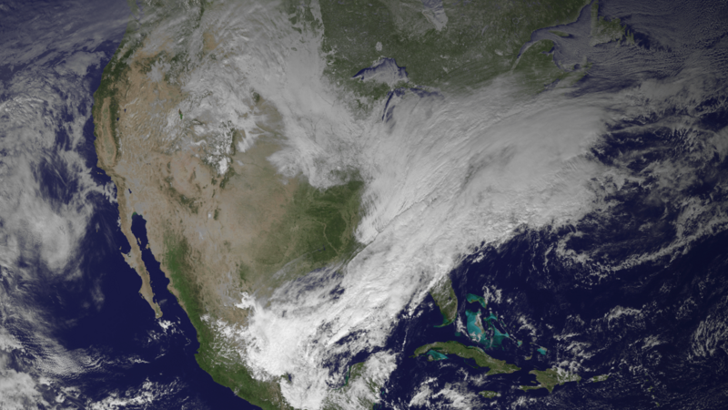
English: A GOES-13 satellite image captured at 17:45 UTC on January 2, 2014, depicting an ongoing blizzard across portions of the Ohio River Valley and the Northeast United States as cold air from Canada moves across warm air from the Gulf of Mexico. |
| Date | |
| Source | http://www.nnvl.noaa.gov/images/high_resolution/1478v1_20140102-GOES-Blizzard.png |
| Author | National Oceanic and Atmospheric Administration |
Licensing
This image is in the public domain because it contains materials that originally came from the U.S. National Oceanic and Atmospheric Administration, taken or made as part of an employee's official duties.
|
File history
Click on a date/time to view the file as it appeared at that time.
| Date/Time | Thumbnail | Dimensions | User | Comment | |
|---|---|---|---|---|---|
| current | 05:34, 8 January 2014 | | 1,920 × 1,080 (1.1 MB) | Wxtrackercody | User created page with UploadWizard |
File usage
The following pages on the English Wikipedia use this file (pages on other projects are not listed):
Global file usage
The following other wikis use this file:
- Usage on de.wikipedia.org
- Usage on es.wikipedia.org
- Usage on fr.wikipedia.org
- Usage on he.wikipedia.org
- Usage on he.wikivoyage.org
- Usage on id.wikipedia.org
- Usage on nl.wikipedia.org
- Usage on vi.wikipedia.org
- Usage on www.wikidata.org
- Usage on zh.wikipedia.org