
File:Cresswell Tower - geograph.org.uk - 1163700.jpg
No higher resolution available.
Cresswell_Tower_-_geograph.org.uk_-_1163700.jpg (640 × 428 pixels, file size: 83 KB, MIME type: image/jpeg)
| This is a file from the Wikimedia Commons. Information from its description page there is shown below. Commons is a freely licensed media file repository. You can help. |
Summary
| Description |
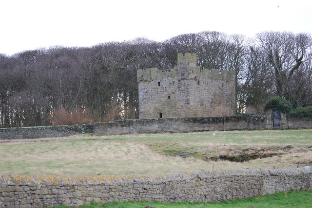
English: Cresswell Tower A medieval tower and home to the Cresswell family in the 14th and 15th centuries. See http://www.keystothepast.info/durhamcc/K2P.nsf/K2PDetail?readform&PRN=N13255 for more of its history. Murray's Handbook (1890) adds fictional romance to the story thus: It (the tower) is said to be haunted by a lady of the family, of whom a Danish prince was enamoured. She was watching from the roof for his coming, when she saw her three brothers murder him upon the shore, after which she starved herself to death in the old tower. |
| Date | |
| Source | From geograph.org.uk |
| Author | hayley green |
| Attribution (required by the license) | hayley green / Cresswell Tower / |
| Camera location | | View this and other nearby images on: OpenStreetMap |
|---|
_heading:247.00&language=en)
| Object location | | View this and other nearby images on: OpenStreetMap |
|---|
_heading:247.00&language=en)
Licensing

|
This image was taken from the Geograph project collection. See this photograph's page on the Geograph website for the photographer's contact details. The copyright on this image is owned by hayley green and is licensed for reuse under the Creative Commons Attribution-ShareAlike 2.0 license.
|
This file is licensed under the Creative Commons Attribution-Share Alike 2.0 Generic license.
Attribution: hayley green
- You are free:
- to share – to copy, distribute and transmit the work
- to remix – to adapt the work
- Under the following conditions:
- attribution – You must give appropriate credit, provide a link to the license, and indicate if changes were made. You may do so in any reasonable manner, but not in any way that suggests the licensor endorses you or your use.
- share alike – If you remix, transform, or build upon the material, you must distribute your contributions under the same or compatible license as the original.
File history
Click on a date/time to view the file as it appeared at that time.
| Date/Time | Thumbnail | Dimensions | User | Comment | |
|---|---|---|---|---|---|
| current | 13:23, 25 February 2011 | | 640 × 428 (83 KB) | GeographBot | == {{int:filedesc}} == {{Information |description={{en|1=Cresswell Tower A medieval tower and home to the Cresswell family in the 14th and 15th centuries. See http://www.keystothepast.info/durhamcc/K2P.nsf/K2PDetail?readform&PRN=N13255 for more of its his |
File usage
The following pages on the English Wikipedia use this file (pages on other projects are not listed):
Global file usage
The following other wikis use this file:
- Usage on dag.wikipedia.org
- Usage on da.wikipedia.org
- Usage on de.wikipedia.org
- Usage on en.wikibooks.org
- Usage on ru.wikipedia.org
- Usage on www.wikidata.org