
File:Corridor pac nw.PNG
No higher resolution available.
Corridor_pac_nw.PNG (517 × 386 pixels, file size: 164 KB, MIME type: image/png)
| This is a file from the Wikimedia Commons. Information from its description page there is shown below. Commons is a freely licensed media file repository. You can help. |
Summary
| Description |
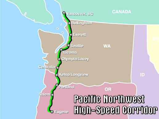
English: Map of Pacific Northwest Corridor, a federally designated high-speed rail corridor. |
||||||
| Date | |||||||
| Source | http://www.fra.dot.gov/us/content/645 | ||||||
| Author | FRA | ||||||
| Permission (Reusing this file) |
|
||||||
| Other versions | Corridor_pac_nw.jpg | ||||||

File history
Click on a date/time to view the file as it appeared at that time.
| Date/Time | Thumbnail | Dimensions | User | Comment | |
|---|---|---|---|---|---|
| current | 15:21, 12 March 2009 | | 517 × 386 (164 KB) | Matjamoe~commonswiki | {{Information |Description={{en|1=Map of Pacific Northwest Corridor, a federally designated high-speed rail corridor.}} |Source=http://www.fra.dot.gov/us/content/645 |Author=FRA |Date=2009 |Permission= |other_versions=Corridor_pac_nw.jpg }} <!--{{ImageUp |
File usage
The following pages on the English Wikipedia use this file (pages on other projects are not listed):
Global file usage
The following other wikis use this file:
- Usage on uk.wikipedia.org