
File:Connah's Quay near site of station geograph-3316477-by-Ben-Brooksbank.jpg
Size of this preview: 800 × 463 pixels. Other resolutions: 320 × 185 pixels | 640 × 370 pixels | 1,196 × 692 pixels.
Original file (1,196 × 692 pixels, file size: 957 KB, MIME type: image/jpeg)
| This is a file from the Wikimedia Commons. Information from its description page there is shown below. Commons is a freely licensed media file repository. You can help. |
Summary
| Description |
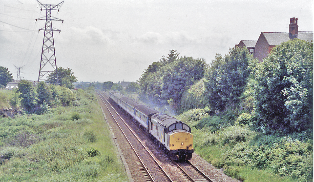
English: Eastward on Chester - Holyhead main line near site of Connah's Quay station, 1994. This view is looking in the opposite direction - i.e. towards Chester, to that in SJ2870 : Chester - Holyhead main line west of site of Connah's Quay station. The same misgivings about the location apply, although the direction and angle of the high-tension electricity transmission pylons support my tentative location. I labelled the photographs at the time as 'Connah's Quay', and I tentatively conclude that the station (closed 14/2/66) would have been just behind the train approaching with a Class 37 Diesel. |
| Date | |
| Source | From geograph.org.uk |
| Author | Ben Brooksbank |
| Permission (Reusing this file) |
Creative Commons Attribution Share-alike license 2.0 |
| Camera location | | View this and other nearby images on: OpenStreetMap |
|---|
Licensing

|
This image was taken from the Geograph project collection. See this photograph's page on the Geograph website for the photographer's contact details. The copyright on this image is owned by Ben Brooksbank and is licensed for reuse under the Creative Commons Attribution-ShareAlike 2.0 license.
|
This file is licensed under the Creative Commons Attribution-Share Alike 2.0 Generic license.
Attribution: Ben Brooksbank
- You are free:
- to share – to copy, distribute and transmit the work
- to remix – to adapt the work
- Under the following conditions:
- attribution – You must give appropriate credit, provide a link to the license, and indicate if changes were made. You may do so in any reasonable manner, but not in any way that suggests the licensor endorses you or your use.
- share alike – If you remix, transform, or build upon the material, you must distribute your contributions under the same or compatible license as the original.
File history
Click on a date/time to view the file as it appeared at that time.
| Date/Time | Thumbnail | Dimensions | User | Comment | |
|---|---|---|---|---|---|
| current | 15:44, 15 February 2013 | | 1,196 × 692 (957 KB) | Chevin | == {{int:filedesc}} == {{Information |Description={{en|1='''Eastward on Chester - Holyhead main line near site of Connah's Quay station, 1994.'''<br/> This view is looking in the opposite direction - i.e. towards Chester, to that in SJ2870 : Chester - ... |
File usage
The following pages on the English Wikipedia use this file (pages on other projects are not listed):
Global file usage
The following other wikis use this file:
- Usage on fi.wikipedia.org
- Usage on www.wikidata.org