
File:Colyton Electric Tram Station - geograph.org.uk - 1802870.jpg
No higher resolution available.
Colyton_Electric_Tram_Station_-_geograph.org.uk_-_1802870.jpg (640 × 438 pixels, file size: 142 KB, MIME type: image/jpeg)
| This is a file from the Wikimedia Commons. Information from its description page there is shown below. Commons is a freely licensed media file repository. You can help. |
Summary
| Description |
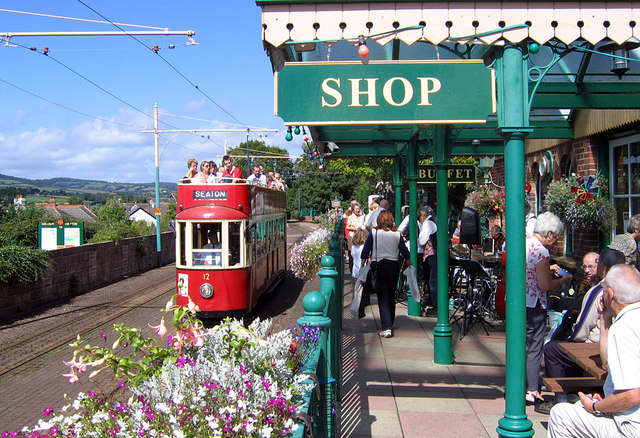
English: Colyton Electric Tram Station The station at the Colyton end of the electric tram route running from Seaton on the coast. This section of branch line was purchased from British Railways when it was threatened with closure in 1966, and modified to accept the electric trams that were then being used at Eastbourne on the Sussex Coast. The entire system at Eastbourne was dismantled and transported to Devon.
For a full 360° interactive panorama of this station, please visit this http://www.360panoramas.co.uk/index.php?page=The+Seaton+Tramway§ion=4&id=89 |
| Date | Taken on 5 September 2006 |
| Source | From geograph.org.uk |
| Author | Malcolm Etherington |
| Camera location | | View this and other nearby images on: OpenStreetMap |
|---|
_heading:337.00&language=en)
| Object location | | View this and other nearby images on: OpenStreetMap |
|---|
_heading:337.00&language=en)
Licensing

|
This image was taken from the Geograph project collection. See this photograph's page on the Geograph website for the photographer's contact details. The copyright on this image is owned by Malcolm Etherington and is licensed for reuse under the Creative Commons Attribution-ShareAlike 2.0 license.
|
This file is licensed under the Creative Commons Attribution-Share Alike 2.0 Generic license.
Attribution: Malcolm Etherington
- You are free:
- to share – to copy, distribute and transmit the work
- to remix – to adapt the work
- Under the following conditions:
- attribution – You must give appropriate credit, provide a link to the license, and indicate if changes were made. You may do so in any reasonable manner, but not in any way that suggests the licensor endorses you or your use.
- share alike – If you remix, transform, or build upon the material, you must distribute your contributions under the same or compatible license as the original.
File history
Click on a date/time to view the file as it appeared at that time.
| Date/Time | Thumbnail | Dimensions | User | Comment | |
|---|---|---|---|---|---|
| current | 12:35, 14 March 2011 | | 640 × 438 (142 KB) | GeographBot | == {{int:filedesc}} == {{Information |description={{en|1=Colyton Electric Tram Station The station at the Colyton end of the electric tram route running from Seaton on the coast. This section of branch line was purchased from British Railways when it was |
File usage
The following pages on the English Wikipedia use this file (pages on other projects are not listed):