
File:Clackline Brook Bridge from west.JPG

Size of this preview: 800 × 533 pixels. Other resolutions: 320 × 213 pixels | 640 × 427 pixels | 1,024 × 683 pixels | 1,280 × 853 pixels | 2,560 × 1,707 pixels | 4,272 × 2,848 pixels.
Original file (4,272 × 2,848 pixels, file size: 2.2 MB, MIME type: image/jpeg)
| This is a file from the Wikimedia Commons. Information from its description page there is shown below. Commons is a freely licensed media file repository. You can help. |
Summary
| Description |
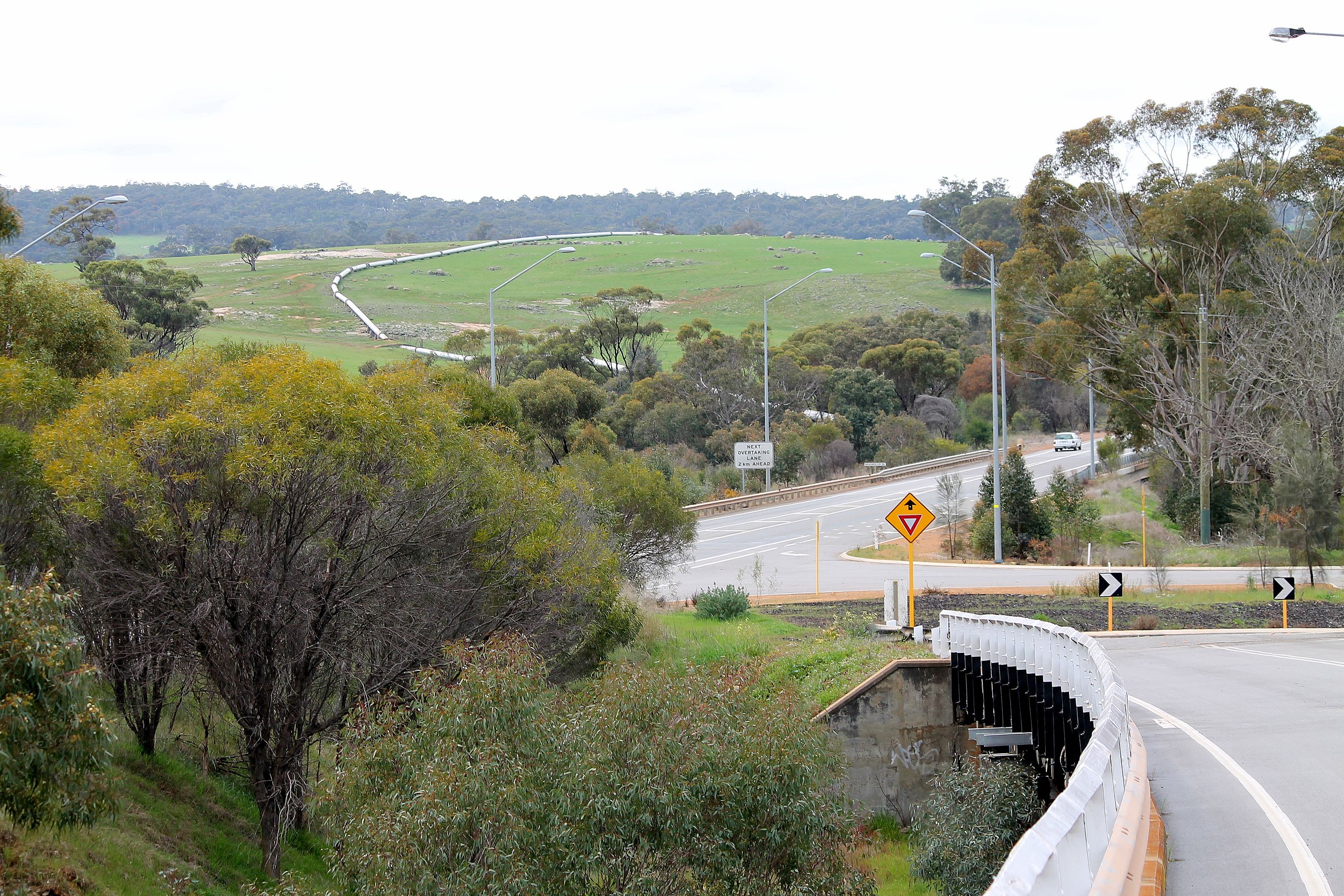
English: Clackline Brook Bridge. The bridge was a road bridge adjacent to the railway bridge that went over the Brook as well. The new alignment of the Great Eastern Highway runs over the brook to the left rear of the photograph view. At this point there was a junction, where the Great Eastern Highway, the Goldfields pipeline, and railways went different directions. It was known as 'Clackline Junction' in early railway publications. |
| Date | |
| Source | Own work |
| Author | User:JarrahTree |
| Camera location | | View this and other nearby images on: OpenStreetMap |
|---|
Licensing
I User:JarrahTree hereby publish Clackline Brook Bridge from west.JPG under Creative Commons Attribution 2.5 Australia License
Attribution requirement;
Photographs by JarrahTree...commons.wikimedia.org
| process functionality required template |
|---|
| process functionality requires a generic template that best reflected image licensing as prescribed above on the 13 September 2012, where there is any difference/conflict/decrepency between what is described above as the image license and this template the above license as indicated takes precedence
JarrahTree, the copyright holder of this work, hereby publishes it under the following license: This file is licensed under the Creative Commons Attribution 2.5 Australia license. Attribution: Photographs by JarrahTree...commons.wikimedia.org
 |
File history
Click on a date/time to view the file as it appeared at that time.
| Date/Time | Thumbnail | Dimensions | User | Comment | |
|---|---|---|---|---|---|
| current | 04:27, 18 August 2014 | | 4,272 × 2,848 (2.2 MB) | Bleakcomb | Correct image. Exposure, contrast, colour, sharpen. |
| 14:36, 27 August 2012 |  | 4,272 × 2,848 (4.93 MB) | JarrahTree | User created page with UploadWizard |
File usage
The following pages on the English Wikipedia use this file (pages on other projects are not listed):
Global file usage
The following other wikis use this file:
- Usage on de.wikipedia.org
- Usage on fa.wikipedia.org