
File:Claas Baseline HD.jpg

Size of this preview: 399 × 599 pixels. Other resolutions: 160 × 240 pixels | 320 × 480 pixels | 512 × 768 pixels | 682 × 1,024 pixels | 1,333 × 2,000 pixels.
Original file (1,333 × 2,000 pixels, file size: 555 KB, MIME type: image/jpeg)
| This is a file from the Wikimedia Commons. Information from its description page there is shown below. Commons is a freely licensed media file repository. You can help. |
| Description |
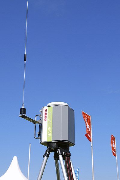
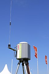
Deutsch: Mobile DGPS-Referenzstation Baseline HD von Claas für den Einsatz bei satellitengestützen Lenksystemen in der Landwirtschaft (Precision Farming); DLG-Feldtage 2010, Gut Bockerode, Springe-Mittelrode, Niedersachsen, Deutschland. – Die transportable Station ist mit einem Einfrequenz-GPS-Empfänger und GPS-Antenne sowie Funkgerät, Funkantenne und Batterie ausgestattet. Sie ermittelt ihre Position innerhalb weniger Minuten und sendet dann per Funk ein DGPS-Korrektursignal an die Landmaschinen auf dem Feld (Funkradius etwa 5 km, ohne dass Sichtkontakt nötig ist). Von den Lenksystemen (Claas GPS PILOT) der mit GPS- und Funk-Empfängern ausgestatteten Maschinen (z.B. Traktoren, Mähdrescher) werden die GPS-Satellitensignale mit dem lizenzfreien Korrektursignal kombiniert und in Lenkimpulse umgesetzt. Mit diesem Claas-System lässt sich eine GPS-Genauigkeit von 4–6 cm erreichen.
English: Mobile tripod-mounted DGPS reference station Baseline HD by Claas for use in satellite-assisted steering systems in agriculture (precision farming); DLG field days 2010, Gut Bockerode, Springe-Mittelrode, Lower Saxony, Germany. – The transportable station is equipped with a single-frequency GPS receiver and a GPS antenna, a radio and FM radio antenna, and a battery. It calculates its position within a few minutes and then sends a DGPS correction signal to on-field machines per radio (within a range of about 5 km, it does not rely on line-of-sight). The steering systems (Claas GPS PILOT) of the machines, that are equipped with GPS and radio receivers (e.g. tractors, combine harvesters), combine the GPS satellite signals with the licence-free DGPS correction signal, and convert them to steering impulses. This Claas system can provide a GPS accuracy of 4–6 cm. |
| Date | |
| Source | Own work |
| Author | bdk |
| Permission (Reusing this file) |
bdk, the copyright holder of this work, hereby publishes it under the following license: This file is licensed under the Creative Commons Attribution-Share Alike 3.0 Unported license. Attribution: bdk
|
| Attribution (required by the license) | © User:bdk / Wikimedia Commons / |
File history
Click on a date/time to view the file as it appeared at that time.
| Date/Time | Thumbnail | Dimensions | User | Comment | |
|---|---|---|---|---|---|
| current | 22:32, 20 June 2010 | | 1,333 × 2,000 (555 KB) | Bdk | {{Information |Description={{de|Mobile Referenzstation ''Baseline HD'' von Category:Claas für den Einsatz bei satellitengestützen Lenksystemen in der Landwirtschaft (''Precision Farming''); DLG-Feldtage 2010, Gut Bockerode, Springe-Mittelrode, Nie |
File usage
The following pages on the English Wikipedia use this file (pages on other projects are not listed):
Global file usage
The following other wikis use this file:
- Usage on de.wikipedia.org
- Usage on es.wikipedia.org
- Usage on fa.wikipedia.org
- Usage on he.wikipedia.org
- Usage on ja.wikipedia.org
- Usage on lv.wikipedia.org
- Usage on pt.wikipedia.org
- Usage on ru.wikipedia.org
- Usage on tr.wikipedia.org
- Usage on uk.wikipedia.org
- Usage on www.wikidata.org