
File:China Liaoning location map.svg

Size of this PNG preview of this SVG file: 140 × 145 pixels. Other resolutions: 232 × 240 pixels | 463 × 480 pixels | 741 × 768 pixels | 989 × 1,024 pixels | 1,977 × 2,048 pixels.
Original file (SVG file, nominally 140 × 145 pixels, file size: 439 KB)
| This is a file from the Wikimedia Commons. Information from its description page there is shown below. Commons is a freely licensed media file repository. You can help. |
Summary
| Description |
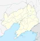
English: Location map of Liaoning, People's Republic of China
Equirectangular projection, N/S stretching 141 %. True scale parallel: 45°00' N. Geographic limits of the map:
|
| Date | |
| Source |
Own work, using
|
| Author | Das steinerne Herz |
| Other versions | Derivative works of this file: China Liaoning relief location map.png |
Licensing
I, the copyright holder of this work, hereby publish it under the following licenses:
This file is licensed under the Creative Commons Attribution-Share Alike 3.0 Unported license.
- You are free:
- to share – to copy, distribute and transmit the work
- to remix – to adapt the work
- Under the following conditions:
- attribution – You must give appropriate credit, provide a link to the license, and indicate if changes were made. You may do so in any reasonable manner, but not in any way that suggests the licensor endorses you or your use.
- share alike – If you remix, transform, or build upon the material, you must distribute your contributions under the same or compatible license as the original.

|
Permission is granted to copy, distribute and/or modify this document under the terms of the GNU Free Documentation License, Version 1.2 or any later version published by the Free Software Foundation; with no Invariant Sections, no Front-Cover Texts, and no Back-Cover Texts. A copy of the license is included in the section entitled GNU Free Documentation License. |
You may select the license of your choice.
File history
Click on a date/time to view the file as it appeared at that time.
| Date/Time | Thumbnail | Dimensions | User | Comment | |
|---|---|---|---|---|---|
| current | 19:39, 23 February 2011 | | 140 × 145 (439 KB) | Das steinerne Herz | correction water layer |
| 19:33, 23 February 2011 |  | 140 × 145 (438 KB) | Das steinerne Herz | completly new version | |
| 16:41, 12 February 2011 |  | 192 × 168 (2.03 MB) | Das steinerne Herz | {{Information |Description ={{en|1=Location map of Liaoning, People's Republic of China Equirectangular projection, N/S stretching 141 %. Geographic limits of the map: * N: 41.5° N * S: 30.5° N * W: |
File usage
More than 100 pages use this file. The following list shows the first 100 pages that use this file only. A full list is available.
- Anshan
- Anshan Teng'ao Airport
- Battle of Lüshunkou
- Bayuquan District
- Beipiao
- Beizhen
- Changhai County
- Changhai Dachangshandao Airport
- Changtu County
- Changxing Island, Dalian
- Chaoyang, Liaoning
- Chaoyang Airport
- Dadong, Shenyang
- Dalian
- Dalian Mosque
- Dalian Zhoushuizi International Airport
- Dandong
- Dandong Langtou Airport
- Dashiqiao
- Dawa District
- Dengta
- Diaobingshan
- Dongfeng, Dawa District
- Donggang, Liaoning
- Dongzhou District
- Faku County
- Fengcheng, Liaoning
- Fengguo Temple
- Fushun
- Fushun War Criminals Management Centre
- Fuxin
- Fuxin Mongol Autonomous County
- Fuzhoucheng
- Gaizhou
- Ganjingzi, Dalian
- Gongchangling District
- Goubangzi
- Guanyinge Subdistrict, Beizhen
- Guanyinge Subdistrict, Benxi County
- Gucheng, Huanren County
- Guta District
- Haicheng, Liaoning
- Harqin Left Wing Mongolian Autonomous County
- Heishan County
- Heping, Shenyang
- Huanggu, Shenyang
- Huanren Manchu Autonomous County
- Huanren Town
- Huludao
- Hunnan, Shenyang
- Jianchang County
- Jianping County
- Jinzhou
- Jinzhou, Dalian
- Jinzhou Xiaolingzi Airport
- Kaiyuan, Liaoning
- Kangping County
- Kuandian Manchu Autonomous County
- Liaoyang
- Liaoyang County
- Liaozhong District
- Linghai
- Lingyuan
- Longwangmiao, Liaoning
- Lüshun Museum
- Lüshunkou, Dalian
- Mukden Palace
- Pailou, Liaoning
- Panjin
- Pulandian, Dalian
- Qingyuan, Qingyuan Manchu Autonomous County
- Shahekou, Dalian
- Shenbei New Area
- Shenhe, Shenyang
- Shenyang
- Shenyang Taoxian International Airport
- Shuangmiao Township, Liaoning
- Shuangta, Pulandian
- Suizhong County
- Sujiatun, Shenyang
- Taiyang Subdistrict
- Tieling
- Tieling County
- Tiexi, Shenyang
- Wafangdian
- Wangshi, Liaoning
- Wanquan Subdistrict
- Xiaoshi, Liaoning
- Xigang, Dalian
- Xinbin, Liaoning
- Xingang Port oil spill
- Xingcheng
- Xinmin, Liaoning
- Xintun Subdistrict
- Xiongyue
- Yingkou
- Yingluo, Liaoning
- Yuhong, Shenyang
- Zhangwu County
- Zhongshan, Dalian
View more links to this file.
Global file usage
The following other wikis use this file:
- Usage on ar.wikipedia.org
- Usage on ba.wikipedia.org
- Usage on bg.wikipedia.org
- Usage on ceb.wikipedia.org
- Usage on de.wikipedia.org
- Usage on es.wikipedia.org
- Lüshunkou
- Shenyang
- Dalian
- Fuxin
- Benxi
- Jinzhou
- Yingkou
- Panjin
- Liaoyang
- Anshan
- Wikiproyecto:Ilustración/Taller de Cartografía/Realizaciones/Asia
- Plantilla:Mapa de localización de Liaoning
- Huanren
- Xinbin
- Zona de desarrollo de Dalian
- Wafangdian
- Zhuanghe
- Playa roja de Panjin
- Kuandian
- Condado de Chaoyang
- Zhongshan (Dalian)
- Xigang
- Sujiatun
- Usage on fa.wikipedia.org
View more global usage of this file.