
File:China Fujian2 location map.svg

Original file (SVG file, nominally 780 × 818 pixels, file size: 277 KB)
| This is a file from the Wikimedia Commons. Information from its description page there is shown below. Commons is a freely licensed media file repository. You can help. |
Summary
| Description |
Quadratische Plattkarte, N-S-Streckung 111 %. Geographische Begrenzung der Karte:
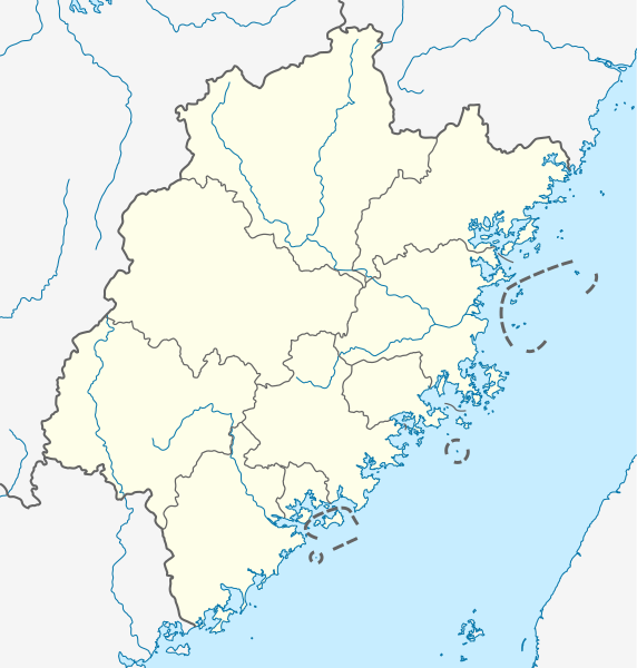
English: Location map of Fujian, People's Republic of China
(Note: the insular counties of Kinmen (Quemoy) and Lienchiang (Matsu Islands), Taiwan (ROC), are shown with dashed lines.) Equirectangular projection, N/S stretching 111 %. Geographic limits of the map:
|
|
| Date | ||
| Source |
Own work, using
|
|
| Author | NordNordWest | |
| Permission (Reusing this file) |
This file is licensed under the Creative Commons Attribution-Share Alike 3.0 Germany license.
 This file is licensed under the Creative Commons Attribution-Share Alike 3.0 Unported license.
|


|
This map has been made or improved in the German Kartenwerkstatt (Map Lab). You can propose maps to improve as well.
|
File history
Click on a date/time to view the file as it appeared at that time.
| Date/Time | Thumbnail | Dimensions | User | Comment | |
|---|---|---|---|---|---|
| current | 17:21, 14 October 2020 | | 780 × 818 (277 KB) | NordNordWest | upd |
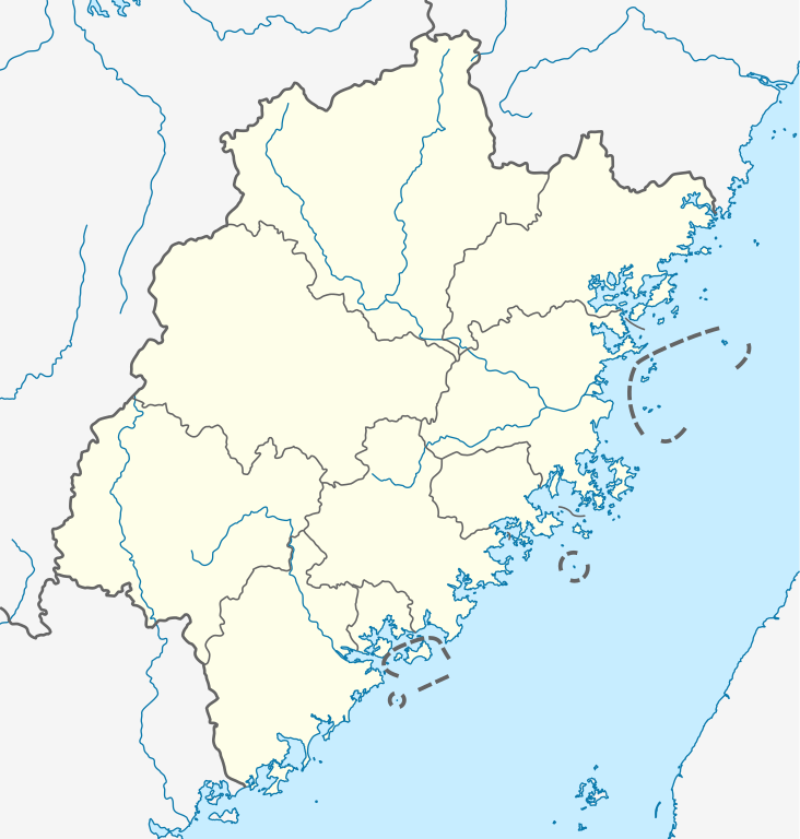
| 12:18, 20 June 2011 |  | 780 × 818 (282 KB) | NordNordWest | =={{int:filedesc}}== {{Information |Description= {{de|Positionskarte von Fujian, Volksrepublik China}} Quadratische Plattkarte, N-S-Streckung 111 %. Geographische Begrenzung der Karte: * N: 28.5° N * S: 23.3° N |
File usage
More than 100 pages use this file. The following list shows the first 100 pages that use this file only. A full list is available.
- Anxi County
- Banzai, Fujian
- Banzhong She Ethnic Township
- Cangshan, Fuzhou
- Changle, Fuzhou
- Chengxiang, Putian
- Datian County
- Dehua County
- Dongshan County
- Fengcheng, Lianjiang County
- Fu'an
- Fuding
- Fujian tulou
- Fuqing
- Fuzhou
- Fuzhou Changle International Airport
- Guanghua Temple (Putian)
- Guangze County
- Gulangyu
- Gulei
- Gulou, Fuzhou
- Gutian, Shanghang County
- Gutian County
- Haicang, Xiamen
- Hanjiang, Putian
- Hokkien
- Hua'an County
- Hui'an County
- Huli, Xiamen
- Jian'ou
- Jiangle County
- Jianning County
- Jianyang, Nanping
- Jiaocheng, Ningde
- Jimei, Xiamen
- Jin'an, Fuzhou
- Jinjiang, Quanzhou
- Kanshi, Fujian
- Liancheng County
- Liancheng Guanzhishan Airport
- Lianjiang County
- Licheng, Putian
- Licheng, Quanzhou
- Linan, Fujian
- Longhai, Zhangzhou
- Longwen, Zhangzhou
- Longyan
- Luojiang, Quanzhou
- Luoyuan County
- Mawei, Fuzhou
- Meilie, Sanming
- Mingxi County
- Minhou County
- Minqing County
- Mount Qingyuan
- Nan'an, Fujian
- Nanjing County
- Ningde
- Ninghua County
- Pinghe County
- Pingnan County, Fujian
- Pingtan County
- Pingtan Island
- Pucheng County, Fujian
- Putian
- Qingliu County
- Quangang, Quanzhou
- Quanzhou
- Quanzhou Jinjiang International Airport
- Rentian, Fujian
- Sanyuan, Sanming
- Shanghang County
- Shaowu
- Shenhu
- Shibi, Fujian
- Shishi, Fujian
- Shouning
- Shunchang County
- Songxi County
- South Putuo Temple
- Sui'an
- Taijiang, Fuzhou
- Taining County
- Taiwan Strait
- Tianluokeng Tulou cluster
- Tong'an, Xiamen
- Wanfu Temple
- Wuping County
- Wuyi Mountains
- Wuyishan, Fujian
- Wuyishan Airport
- Xiamen Gaoqi International Airport
- Xiamen Island
- Xiang'an, Xiamen
- Xiangcheng, Zhangzhou
- Xiaoxi, Fujian
- Xiuyu, Putian
- Yong'an
- Yongtai County
- Yunxiao
View more links to this file.
Global file usage
The following other wikis use this file:
- Usage on ar.wikipedia.org
- Usage on bg.wikipedia.org
- Usage on bn.wikipedia.org
- Usage on cdo.wikipedia.org
- Usage on ceb.wikipedia.org
- Usage on cs.wikipedia.org
- Usage on fa.wikipedia.org
View more global usage of this file.