
File:Chatterley station geograph-3083894-by-Ben-Brooksbank.jpg
Size of this preview: 800 × 498 pixels. Other resolutions: 320 × 199 pixels | 640 × 398 pixels | 897 × 558 pixels.
Original file (897 × 558 pixels, file size: 200 KB, MIME type: image/jpeg)
| This is a file from the Wikimedia Commons. Information from its description page there is shown below. Commons is a freely licensed media file repository. You can help. |
Summary
| Description |
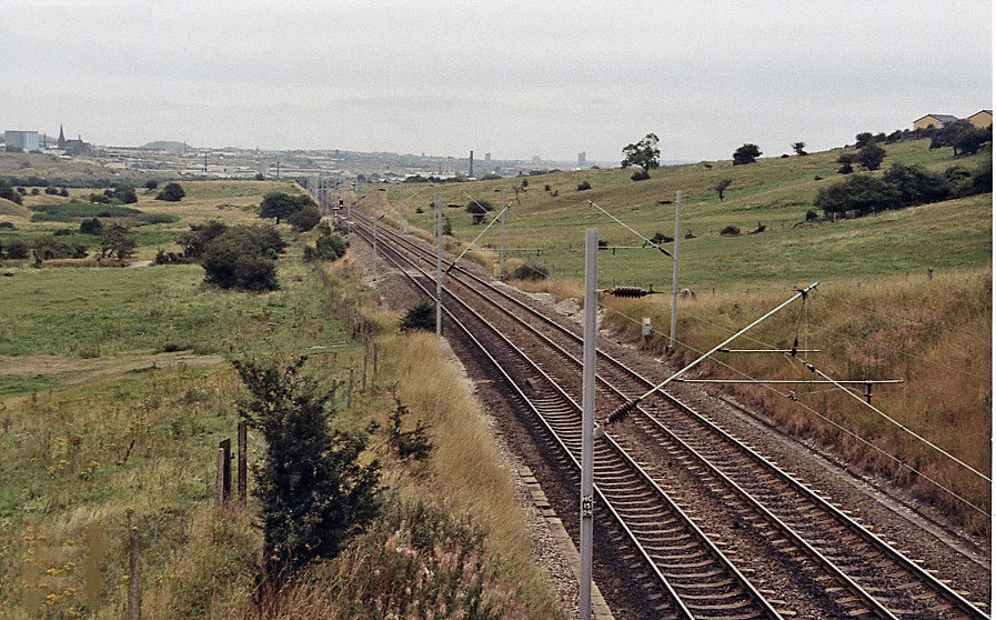
English: Southward at the site of Chatterley station, north of Stoke-on-Trent. View southward, towards Stoke-on-Trent etc., eventually London, on the ex-North Stafford main line, which was electrified in the 1960s as part of the West Coast Main Line first scheme from London Euston to Manchester, via Crewe and via Stoke. Behind the camera, the original lines through the three Harecastle Tunnels had been replaced by a 2½-mile deviation with one short tunnel. |
| Date | |
| Source | From geograph.org.uk |
| Author | Ben Brooksbank |
| Permission (Reusing this file) |
Creative Commons Attribution Share-alike license 2.0 |
| Attribution (required by the license) | Ben Brooksbank / Southward at the site of Chatterley station, north of Stoke-on-Trent / |
| Camera location | | View this and other nearby images on: OpenStreetMap |
|---|
Licensing

|
This image was taken from the Geograph project collection. See this photograph's page on the Geograph website for the photographer's contact details. The copyright on this image is owned by Ben Brooksbank and is licensed for reuse under the Creative Commons Attribution-ShareAlike 2.0 license.
|
This file is licensed under the Creative Commons Attribution-Share Alike 2.0 Generic license.
Attribution: Ben Brooksbank
- You are free:
- to share – to copy, distribute and transmit the work
- to remix – to adapt the work
- Under the following conditions:
- attribution – You must give appropriate credit, provide a link to the license, and indicate if changes were made. You may do so in any reasonable manner, but not in any way that suggests the licensor endorses you or your use.
- share alike – If you remix, transform, or build upon the material, you must distribute your contributions under the same or compatible license as the original.
File history
Click on a date/time to view the file as it appeared at that time.
| Date/Time | Thumbnail | Dimensions | User | Comment | |
|---|---|---|---|---|---|
| current | 18:52, 17 August 2012 | | 897 × 558 (200 KB) | Chevin | == {{int:filedesc}} == {{Information |Description={{en|1='''Southward at the site of Chatterley station, north of Stoke-on-Trent.'''<br/> View southward, towards Stoke-on-Trent etc., eventually London, on the ex-North Stafford main line, which was elec... |
File usage
The following pages on the English Wikipedia use this file (pages on other projects are not listed):