
File:Central Railway Route.svg

Size of this PNG preview of this SVG file: 585 × 600 pixels. Other resolutions: 234 × 240 pixels | 468 × 480 pixels | 749 × 768 pixels | 998 × 1,024 pixels | 1,997 × 2,048 pixels.
Original file (SVG file, nominally 585 × 600 pixels, file size: 81 KB)
| This is a file from the Wikimedia Commons. Information from its description page there is shown below. Commons is a freely licensed media file repository. You can help. |
Summary
| Description |
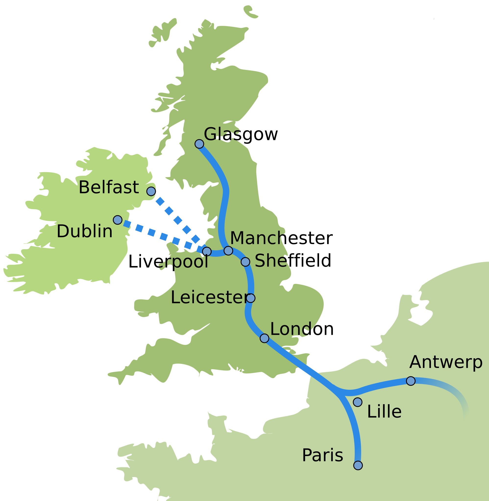
Central Railway's proposed route. Based on an image on the English Wikipedia. Based land's shape on Image:Languages_Europe.svg. |
| Date | 29 October 2007 (original upload date) |
| Source | No machine-readable source provided. Own work assumed (based on copyright claims). |
| Author | No machine-readable author provided. Rugby471 assumed (based on copyright claims). |
| SVG development |
Licensing
| I, the copyright holder of this work, release this work into the public domain. This applies worldwide. In some countries this may not be legally possible; if so: I grant anyone the right to use this work for any purpose, without any conditions, unless such conditions are required by law. |
File history
Click on a date/time to view the file as it appeared at that time.
| Date/Time | Thumbnail | Dimensions | User | Comment | |
|---|---|---|---|---|---|
| current | 11:52, 29 November 2013 | | 585 × 600 (81 KB) | Bastin | Correct city locations. Make route less circuitous (route to Glasgow now depicted as following the WCML, route from London to Leicester now depicted as going via Rugby, as the Great Central did, rather than seemingly Birmingham). |
| 19:59, 29 October 2007 |  | 585 × 600 (82 KB) | Rugby471 | Central Railway's new line route. Based on an image on the English Wikipedia. |
File usage
The following pages on the English Wikipedia use this file (pages on other projects are not listed):
Global file usage
The following other wikis use this file:
- Usage on ja.wikipedia.org