
File:Caribe-geográfico.svg

Size of this PNG preview of this SVG file: 800 × 480 pixels. Other resolutions: 320 × 192 pixels | 1,024 × 614 pixels | 1,280 × 768 pixels | 2,560 × 1,536 pixels | 1,500 × 900 pixels.
Original file (SVG file, nominally 1,500 × 900 pixels, file size: 86 KB)
| This is a file from the Wikimedia Commons. Information from its description page there is shown below. Commons is a freely licensed media file repository. You can help. |
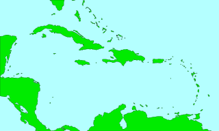
| Description | Mapa de las costas del mar Caribe Mar |
| Date | 1-08-2007 |
| Source | It is based in en:Image:CaribbeanIslands.png, converted to svg by User:FAR |
| Author |
| I, the copyright holder of this work, release this work into the public domain. This applies worldwide. In some countries this may not be legally possible; if so: I grant anyone the right to use this work for any purpose, without any conditions, unless such conditions are required by law. |
File history
Click on a date/time to view the file as it appeared at that time.
| Date/Time | Thumbnail | Dimensions | User | Comment | |
|---|---|---|---|---|---|
| current | 13:57, 3 August 2007 | | 1,500 × 900 (86 KB) | FAR | {{Information |Description=Mapa de las costas del mar Caribe Mar |Source=It is based in en:Image:CaribbeanIslands.png, converted to svg by User:FAR |Date=2-08-2007 |Permission=See Below |other_versions= }} {{PD}} [[Category:Maps of the Caribbea |
| 18:26, 1 August 2007 |  | 1,500 × 900 (71 KB) | FAR | {{Information |Description=Mapa de las costas del mar Caribe Mar |Source=It is based in Image:CaribbeanIslands.png, converted to svg by User:FAR |Date=1-08-2007 |Permission=See Below |other_versions= }} {{PD}} |
File usage
The following pages on the English Wikipedia use this file (pages on other projects are not listed):
Global file usage
The following other wikis use this file:
- Usage on cy.wikipedia.org
- Antigwa a Barbiwda
- Anguilla
- Baner Antigwa a Barbiwda
- Sant Vincent a'r Grenadines
- Sant Kitts-Nevis
- Ynysoedd Caiman
- Nodyn:Eginyn y Caribî
- Puerto Rico
- Montserrat
- .ag
- .bm
- .gd
- .kn
- .pr
- .vc
- .ai
- The Valley
- Sandy Ground
- God Bless Anguilla
- Guadeloupe
- Antilles yr Iseldiroedd
- Trinidad
- Ynysoedd Turks a Caicos
- Martinique
- Arwba
- Bryniau Soufrière
- Brades
- Tobago
- Daeargryn Haiti 2010
- Oranjestad
- Basseterre
- Basse-Terre
- Antilles Leiaf
- Ynysoedd ABC
- Curaçao
- Ynysoedd SSS
- Saint Barthélemy
- Ynysoedd Prydeinig y Wyryf
- Ynysoedd Americanaidd y Wyryf
- Baner Puerto Rico
- Cymuned Saint Martin Ffrengig
- Sint Maarten
- Usage on es.wikipedia.org
- Usage on ko.wikipedia.org
- Usage on nl.wikipedia.org
- Usage on os.wikipedia.org
- Usage on pt.wikipedia.org
- Usage on sw.wikipedia.org
View more global usage of this file.