
File:Buñol-Mapa de la Hoya de Buñol.svg

Size of this PNG preview of this SVG file: 400 × 400 pixels. Other resolutions: 240 × 240 pixels | 480 × 480 pixels | 768 × 768 pixels | 1,024 × 1,024 pixels | 2,048 × 2,048 pixels.
Original file (SVG file, nominally 400 × 400 pixels, file size: 169 KB)
| This is a file from the Wikimedia Commons. Information from its description page there is shown below. Commons is a freely licensed media file repository. You can help. |
| Description |
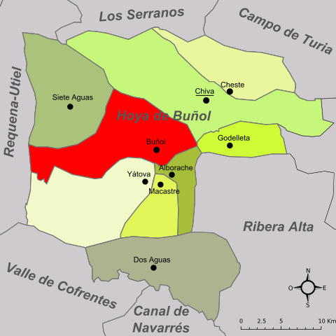
Español: Localización de Buñol en la Hoya de Buñol |
| Date | Original: december 2004. Vectorization: february 2008 |
| Source | Image:Valencia - Mapa municipal.svg, Image:Mapa de la Foia de Bunyol.png, Image:Mapa de la Hoya de Buñol.svg |
| Author | Original: Montxo Vicente i Sempere, uploaded by Martorell, vectorized by Rodriguillo |
| Permission (Reusing this file) |
This file is licensed under the Creative Commons Attribution-Share Alike 2.0 Generic license.
|
| SVG development |
File history
Click on a date/time to view the file as it appeared at that time.
| Date/Time | Thumbnail | Dimensions | User | Comment | |
|---|---|---|---|---|---|
| current | 16:32, 26 November 2014 | | 400 × 400 (169 KB) | Wereldburger758 | Cleanup of file. Valid SVG now. |
| 22:31, 7 February 2008 |  | 400 × 400 (231 KB) | Ignacio Icke | {{Information |Description= {{es|Localización de Buñol en la Hoya de Buñol}} |Source=Image:Valencia - Mapa municipal.svg, Image:Mapa de la Foia de Bunyol.png, Image:Mapa de la Hoya de Buñol.svg |Date=Original: december 2004. Vectorizati |
File usage
The following pages on the English Wikipedia use this file (pages on other projects are not listed):