
File:Bromfield (Cumberland) Station site of 1917769 6f3975b2.jpg
No higher resolution available.
Bromfield_(Cumberland)_Station_site_of_1917769_6f3975b2.jpg (640 × 383 pixels, file size: 112 KB, MIME type: image/jpeg)
| This is a file from the Wikimedia Commons. Information from its description page there is shown below. Commons is a freely licensed media file repository. You can help. |
_Station_site_of_1917769_6f3975b2.jpg)
Summary
| Description |
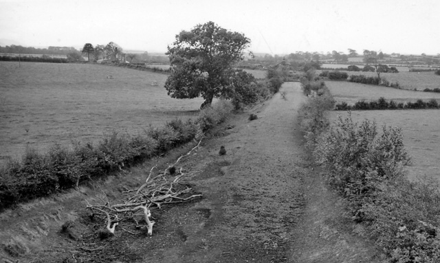
English: Site of Bromfield (Cumberland) Station. View southward, towards Brayton; ex-Caledonian (Solway Junction) line, Kirtlebridge - Annan - Solway Viaduct - Brayton. The line over the Solway Viaduct and south to Brayton together with Bromfield station had been closed for 40 years, since 1/9/21. See also my NY2162 : Bowness-on-Solway Station (converted) and NY1643 : Brayton Station (remains). |
| Date | |
| Source | From geograph.org.uk |
| Author | Ben Brooksbank |
| Permission (Reusing this file) |
Creative Commons Attribution Share-alike license 2.0 |
| Camera location | | View this and other nearby images on: OpenStreetMap |
|---|
_Station_site_of_1917769_6f3975b2.jpg¶ms=054.808483_N_-003.289469_E_globe:Earth_type:camera_heading:180.00&language=en)
Licensing

|
This image was taken from the Geograph project collection. See this photograph's page on the Geograph website for the photographer's contact details. The copyright on this image is owned by Ben Brooksbank and is licensed for reuse under the Creative Commons Attribution-ShareAlike 2.0 license.
|
This file is licensed under the Creative Commons Attribution-Share Alike 2.0 Generic license.
Attribution: Ben Brooksbank
- You are free:
- to share – to copy, distribute and transmit the work
- to remix – to adapt the work
- Under the following conditions:
- attribution – You must give appropriate credit, provide a link to the license, and indicate if changes were made. You may do so in any reasonable manner, but not in any way that suggests the licensor endorses you or your use.
- share alike – If you remix, transform, or build upon the material, you must distribute your contributions under the same or compatible license as the original.
File history
Click on a date/time to view the file as it appeared at that time.
| Date/Time | Thumbnail | Dimensions | User | Comment | |
|---|---|---|---|---|---|
| current | 10:59, 23 January 2011 | | 640 × 383 (112 KB) | Belaro | == {{int:filedesc}} == {{Information |Description={{en|1=Site of Bromfield (Cumberland) Station View southward, towards Brayton; ex-Caledonian (Solway Junction) line, Kirtlebridge - Annan - Solway Viaduct - Brayton. The line over the Solway Viaduct and so |
File usage
The following pages on the English Wikipedia use this file (pages on other projects are not listed):
Global file usage
The following other wikis use this file:
- Usage on www.wikidata.org
_Station_site_of_1917769_6f3975b2.jpg)