
File:Bridge over the River Dove, near Burton-on-Trent - geograph.org.uk - 1656504.jpg
No higher resolution available.
Bridge_over_the_River_Dove,_near_Burton-on-Trent_-_geograph.org.uk_-_1656504.jpg (640 × 431 pixels, file size: 133 KB, MIME type: image/jpeg)
| This is a file from the Wikimedia Commons. Information from its description page there is shown below. Commons is a freely licensed media file repository. You can help. |
Summary
| Description |
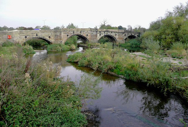
English: Bridge over the River Dove, near Burton-on-Trent. This fine stone road bridge used to carry the A38 road before the recent dual carriageway upgrades round Burton were constructed in 1967/8. Seen from the aqueduct carrying the Trent and Mersey Canal.
Alan was on the towpath side of the canal and about 50 metres to the east. 955075 |
| Date | |
| Source | From geograph.org.uk |
| Author | Roger Kidd |
| Attribution (required by the license) | Roger Kidd / Bridge over the River Dove, near Burton-on-Trent / |
| Camera location | | View this and other nearby images on: OpenStreetMap |
|---|
_heading:22.00&language=en)
| Object location | | View this and other nearby images on: OpenStreetMap |
|---|
_heading:22.00&language=en)
Licensing

|
This image was taken from the Geograph project collection. See this photograph's page on the Geograph website for the photographer's contact details. The copyright on this image is owned by Roger Kidd and is licensed for reuse under the Creative Commons Attribution-ShareAlike 2.0 license.
|
This file is licensed under the Creative Commons Attribution-Share Alike 2.0 Generic license.
Attribution: Roger Kidd
- You are free:
- to share – to copy, distribute and transmit the work
- to remix – to adapt the work
- Under the following conditions:
- attribution – You must give appropriate credit, provide a link to the license, and indicate if changes were made. You may do so in any reasonable manner, but not in any way that suggests the licensor endorses you or your use.
- share alike – If you remix, transform, or build upon the material, you must distribute your contributions under the same or compatible license as the original.
File history
Click on a date/time to view the file as it appeared at that time.
| Date/Time | Thumbnail | Dimensions | User | Comment | |
|---|---|---|---|---|---|
| current | 20:31, 4 March 2011 | | 640 × 431 (133 KB) | GeographBot | == {{int:filedesc}} == {{Information |description={{en|1=Bridge over the River Dove, near Burton-on-Trent This fine stone road bridge used to carry the A38 road before the recent dual carriageway upgrades round Burton were constructed in 1967/8. Seen from |
File usage
The following pages on the English Wikipedia use this file (pages on other projects are not listed):