
File:Bosnia and Herzegovina location map.svg

Size of this PNG preview of this SVG file: 628 × 599 pixels. Other resolutions: 252 × 240 pixels | 503 × 480 pixels | 805 × 768 pixels | 1,074 × 1,024 pixels | 2,147 × 2,048 pixels | 1,063 × 1,014 pixels.
Original file (SVG file, nominally 1,063 × 1,014 pixels, file size: 141 KB)
| This is a file from the Wikimedia Commons. Information from its description page there is shown below. Commons is a freely licensed media file repository. You can help. |
Summary
| Description |
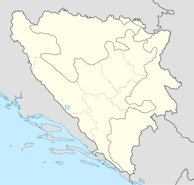
Deutsch: Positionskarte von Bosnien und Herzegowina
Quadratische Plattkarte, N-S-Streckung 140 %. Geographische Begrenzung der Karte:
English: Location map of Bosnia and Herzegovina
Equirectangular projection, N/S stretching 140 %. Geographic limits of the map:
|
| Date | |
| Source | own work, using United States National Imagery and Mapping Agency data |
| Author | NordNordWest |
| Other versions |
|


|
This map has been made or improved in the German Kartenwerkstatt (Map Lab). You can propose maps to improve as well.
|
Licensing
I, the copyright holder of this work, hereby publish it under the following licenses:

|
Permission is granted to copy, distribute and/or modify this document under the terms of the GNU Free Documentation License, Version 1.2 or any later version published by the Free Software Foundation; with no Invariant Sections, no Front-Cover Texts, and no Back-Cover Texts. A copy of the license is included in the section entitled GNU Free Documentation License. |
This file is licensed under the Creative Commons Attribution-Share Alike 3.0 Unported license.
- You are free:
- to share – to copy, distribute and transmit the work
- to remix – to adapt the work
- Under the following conditions:
- attribution – You must give appropriate credit, provide a link to the license, and indicate if changes were made. You may do so in any reasonable manner, but not in any way that suggests the licensor endorses you or your use.
- share alike – If you remix, transform, or build upon the material, you must distribute your contributions under the same or compatible license as the original.
You may select the license of your choice.
File history
Click on a date/time to view the file as it appeared at that time.
| Date/Time | Thumbnail | Dimensions | User | Comment | |
|---|---|---|---|---|---|
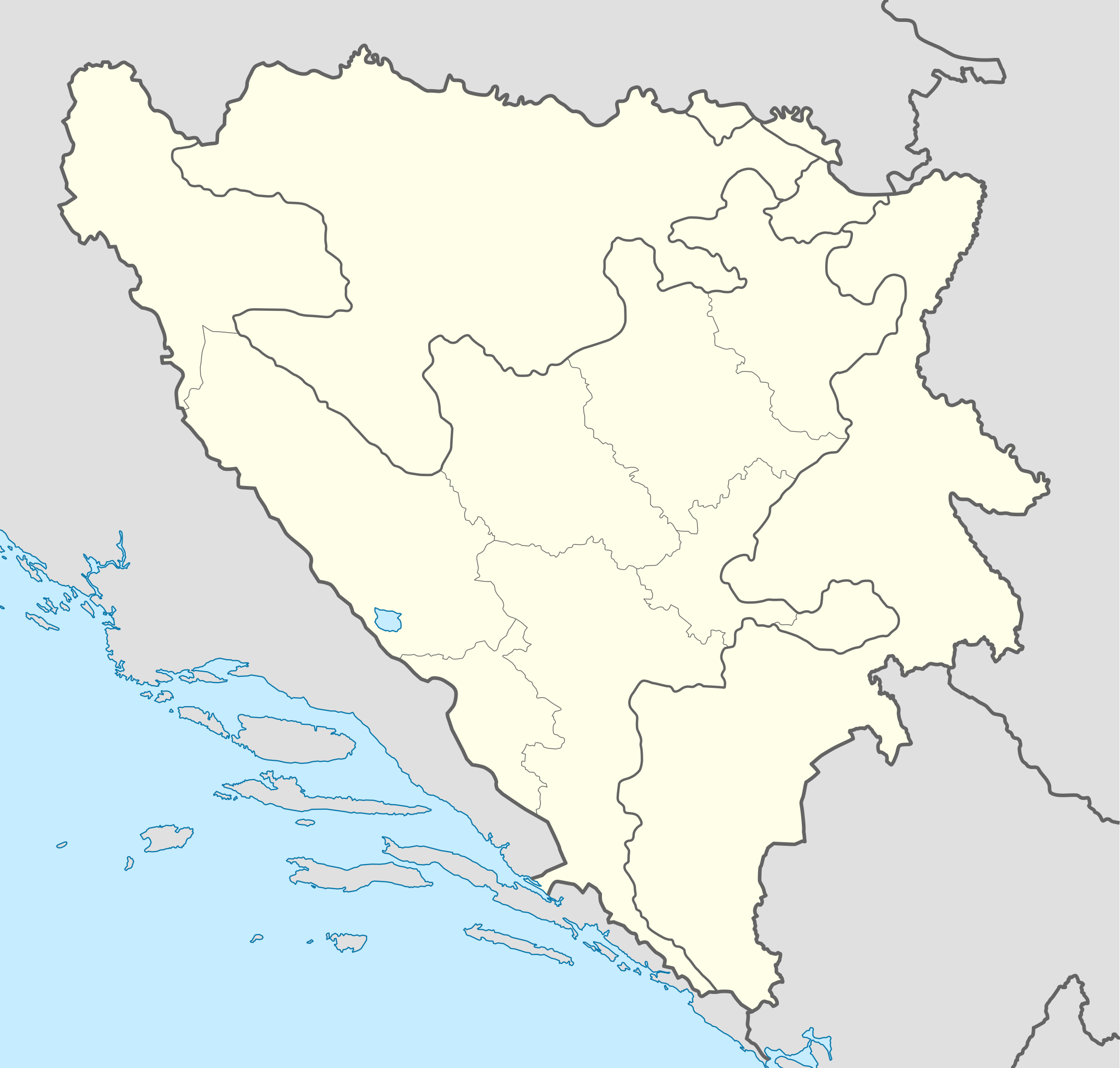
| current | 19:21, 10 November 2011 | | 1,063 × 1,014 (141 KB) | NordNordWest | at least we should keep lake Buško |
| 18:22, 10 November 2011 |  | 1,063 × 1,014 (143 KB) | Mostarac | Regije u RS-u imaju samo statističku funkciju, za razliku od županija/kantona u FBiH, koje su uprave podjedinice! | |
| 11:06, 3 October 2011 |  | 1,063 × 1,014 (148 KB) | NordNordWest | upd | |
| 16:19, 27 September 2011 |  | 1,063 × 1,014 (143 KB) | AnelZukic | once again reverted the changes, I'm givin up | |
| 16:16, 27 September 2011 | No thumbnail | 0 × 0 (4.63 MB) | AnelZukic | added Republika Srpka regions | |
| 15:08, 27 September 2011 |  | 1,063 × 1,014 (143 KB) | AnelZukic | reverted the changes | |
| 15:03, 27 September 2011 |  | 1,280 × 1,208 (35 KB) | AnelZukic | Added regions in Republika Srpska | |
| 14:19, 11 April 2011 |  | 1,063 × 1,014 (143 KB) | NordNordWest | upd | |
| 18:48, 25 August 2008 |  | 1,064 × 1,016 (223 KB) | NordNordWest | size correction | |
| 19:37, 30 July 2008 |  | 709 × 677 (220 KB) | NordNordWest | {{Information |Description= {{de|Positionskarte von Bosnien und Herzegowina}} Quadratische Plattkarte, N-S-Streckung 140 %. Geographische Begrenzung der Karte: * N: 45.4° N * S: 42.4° N * W: 15.5° O * O: 19.9° O {{en|Lo |
File usage
More than 100 pages use this file. The following list shows the first 100 pages that use this file only. A full list is available.
- Ahmići
- Banja Luka International Airport
- Banovići
- Basketball Championship of Bosnia and Herzegovina
- Baščaršija
- Bihać
- Bosansko Grahovo
- Brčko
- Bugojno
- Busovača
- Butmir
- Cazin
- Domaljevac
- Fortress of Doboj
- Garevac
- Gornji Vakuf-Uskoplje
- Gradačac
- Grude
- Handball Championship of Bosnia and Herzegovina
- Heliodrom camp
- Ilijaš
- Jablanica, Bosnia and Herzegovina
- Keraterm camp
- Kladanj
- Ključ, Una-Sana Canton
- Klokotnica (Doboj Istok)
- Kornica, Bosnia and Herzegovina
- Kostajnica, Bosnia and Herzegovina
- Kravica
- Kreševo
- List of football clubs in Bosnia and Herzegovina
- List of protected areas of Bosnia and Herzegovina
- List of top-division football clubs in UEFA countries
- Livno
- Ljubuški
- Lukavac
- Maglaj
- Medjugorje
- Misoča
- Mlječanica
- Mostar International Airport
- Novi Travnik
- Odžak
- Old town of Visoki
- Olovo
- Omarska
- Omarska camp
- Operation Deny Flight
- Orahov Do
- Ostrovica, Bosnia and Herzegovina
- Posušje
- Požarnica
- Premier League of Bosnia and Herzegovina
- Prozor-Rama
- Prusac
- RK Izviđač
- Rakovica, Bosnia and Herzegovina
- Sanski Most
- Sarajevo International Airport
- Skelani
- Sovići
- Srebrenica massacre
- Srebrenik
- Stopan
- Stupni Do
- Teočak
- Tihaljina
- Tomislavgrad
- Torlakovac
- Travnik
- Trebinje
- Trnopolje camp
- Tuzla Air Base
- Tuzla International Airport
- Tvrdoš Monastery
- University Clinical Hospital Mostar
- Ustiprača
- Vareš
- Velika Kladuša
- Vilina Vlas
- Visoko
- Vitez
- Vogošća
- Vojno
- Zavidovići
- Zenica
- Čardak (Modriča)
- Čelebići camp
- Čelić
- Čerigaj
- Čerin
- Čitluk, Herzegovina-Neretva Canton
- Šamac, Bosnia and Herzegovina
- Široki Brijeg
- Žepa
- Žepče
- Žitomislić Monastery
- Živinice
- User:Argo Navis/Bosnia map/East
- User:Argo Navis/Bosnia map/North
View more links to this file.
Global file usage
The following other wikis use this file:
- Usage on af.wikipedia.org
- Usage on als.wikipedia.org
- Usage on an.wikipedia.org
- Usage on ar.wikipedia.org
- Usage on arz.wikipedia.org
- Usage on ast.wikipedia.org
- Usage on av.wikipedia.org
- Usage on azb.wikipedia.org
- Usage on az.wikipedia.org
View more global usage of this file.