
File:BRB orthographic.svg

Size of this PNG preview of this SVG file: 600 × 600 pixels. Other resolutions: 240 × 240 pixels | 480 × 480 pixels | 768 × 768 pixels | 1,024 × 1,024 pixels | 2,048 × 2,048 pixels.
Original file (SVG file, nominally 600 × 600 pixels, file size: 1.18 MB)
| This is a file from the Wikimedia Commons. Information from its description page there is shown below. Commons is a freely licensed media file repository. You can help. |
This is Barbados named after either a tree or flower
Summary
| Description |
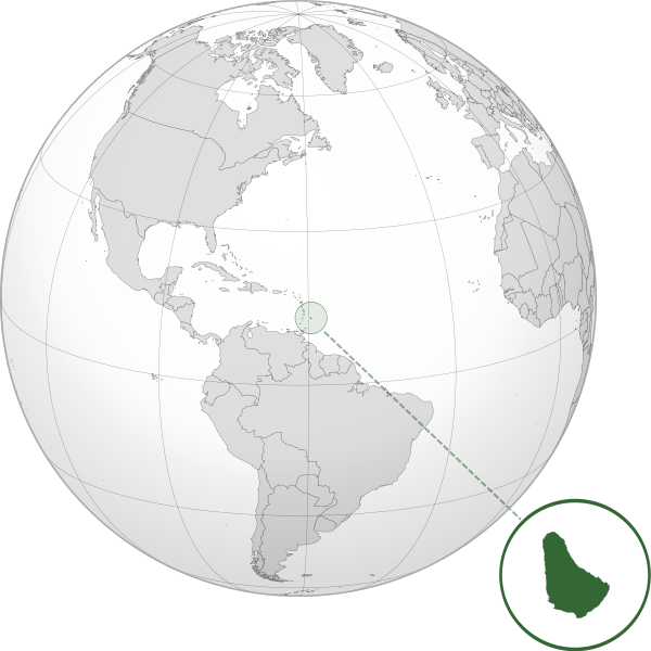
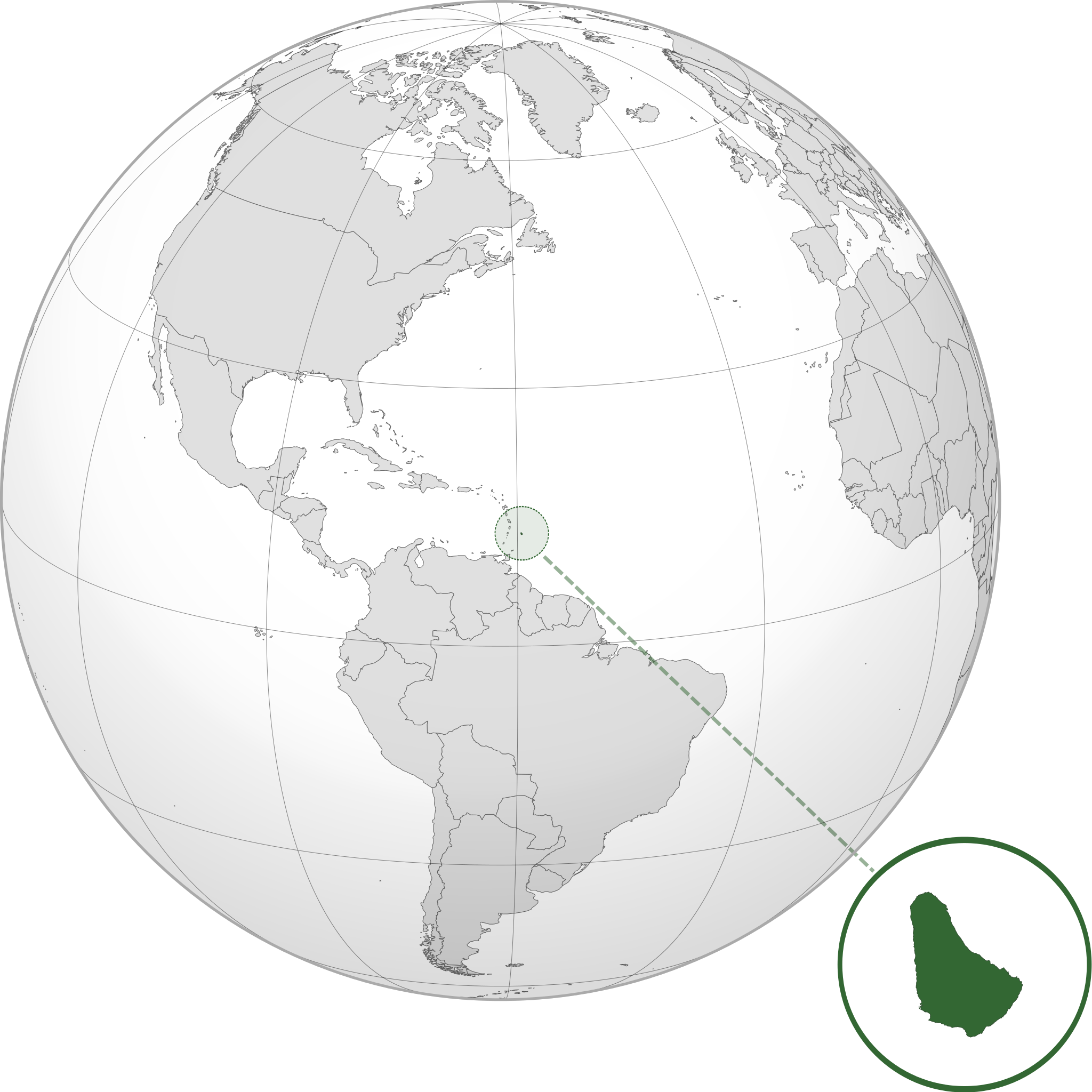
English: Orthographic map of Barbados centered at 17° N, 62° W.
Official territory.
Claimed territories. |
| Date | |
| Source |
Own work with Natural Earth Data This W3C-unspecified vector image was created with Inkscape . |
| Author | Addicted04 |
{{more information talk to hannahdouville} (optional)
Licensing
I, the copyright holder of this work, hereby publish it under the following license:
This file is licensed under the Creative Commons Attribution-Share Alike 3.0 Unported license.
- You are free:
- to share – to copy, distribute and transmit the work
- to remix – to adapt the work
- Under the following conditions:
- attribution – You must give appropriate credit, provide a link to the license, and indicate if changes were made. You may do so in any reasonable manner, but not in any way that suggests the licensor endorses you or your use.
- share alike – If you remix, transform, or build upon the material, you must distribute your contributions under the same or compatible license as the original.
File history
Click on a date/time to view the file as it appeared at that time.
| Date/Time | Thumbnail | Dimensions | User | Comment | |
|---|---|---|---|---|---|
| current | 22:15, 8 July 2012 | | 600 × 600 (1.18 MB) | Addicted04 |
File usage
The following pages on the English Wikipedia use this file (pages on other projects are not listed):
Global file usage
The following other wikis use this file:
- Usage on af.wikipedia.org
- Usage on ami.wikipedia.org
- Usage on ar.wikipedia.org
- باربادوس
- مستخدم:جار الله/قائمة صور مقالات العلاقات الثنائية
- العلاقات الأمريكية الباربادوسية
- العلاقات الأنغولية الباربادوسية
- العلاقات الباربادوسية الكورية الجنوبية
- العلاقات الإريترية الباربادوسية
- العلاقات الباربادوسية السويسرية
- العلاقات الألمانية الباربادوسية
- العلاقات الباربادوسية الليختنشتانية
- العلاقات الباربادوسية البوليفية
- العلاقات الباربادوسية الموزمبيقية
- العلاقات الألبانية الباربادوسية
- العلاقات الباربادوسية البلجيكية
- العلاقات الإثيوبية الباربادوسية
- العلاقات الباربادوسية البيلاروسية
- العلاقات الباربادوسية الطاجيكستانية
- العلاقات الباربادوسية الروسية
- العلاقات الباربادوسية الرومانية
- العلاقات الأرجنتينية الباربادوسية
- العلاقات الباربادوسية الغامبية
- العلاقات الباربادوسية القبرصية
- العلاقات الباربادوسية السيراليونية
- العلاقات الباربادوسية النيبالية
- العلاقات الباربادوسية الليبيرية
- العلاقات التشيكية الباربادوسية
- العلاقات الباربادوسية الميانمارية
- العلاقات السعودية الباربادوسية
- العلاقات الباربادوسية الكندية
- العلاقات الباربادوسية الزيمبابوية
- العلاقات الإسرائيلية الباربادوسية
- العلاقات الباربادوسية البالاوية
- العلاقات الباربادوسية المالية
- العلاقات الباربادوسية النيجيرية
- العلاقات اليمنية الباربادوسية
- العلاقات الباربادوسية الفانواتية
- العلاقات الغابونية الباربادوسية
- العلاقات الباربادوسية البنمية
- العلاقات الباربادوسية الكوبية
- العلاقات الباربادوسية الجورجية
- العلاقات الباربادوسية التونسية
- العلاقات الباربادوسية الكورية الشمالية
- العلاقات الهندية الباربادوسية
- العلاقات اليابانية الباربادوسية
- العلاقات الإيطالية الباربادوسية
- العلاقات الباربادوسية الناوروية
- العلاقات الأسترالية الباربادوسية
- العلاقات الباربادوسية الزامبية
- العلاقات الباربادوسية الفيجية
View more global usage of this file.