
File:BOM Radars Range Map 2022.jpg

Size of this preview: 800 × 534 pixels. Other resolutions: 320 × 213 pixels | 640 × 427 pixels | 1,024 × 683 pixels | 1,280 × 854 pixels | 2,560 × 1,708 pixels | 3,847 × 2,566 pixels.
Original file (3,847 × 2,566 pixels, file size: 407 KB, MIME type: image/jpeg)
| This is a file from the Wikimedia Commons. Information from its description page there is shown below. Commons is a freely licensed media file repository. You can help. |
Summary
| Description |
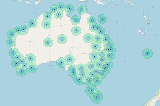
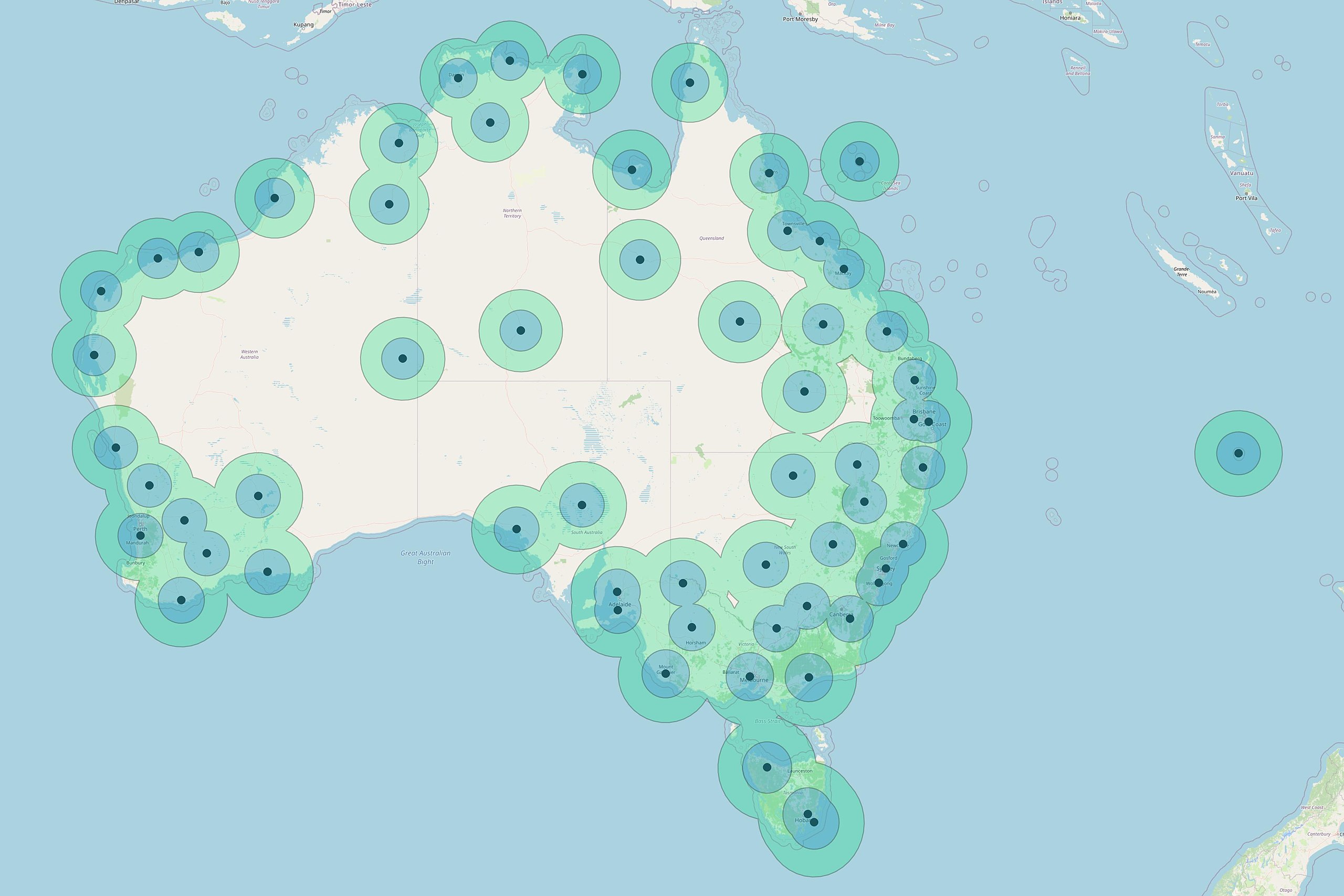
English: Map of BOM Radars with indicative range - 100km inner buffer, 200km outer buffer |
| Date | |
| Source | OpenStreetMap basemap (https://www.openstreetmap.org/copyright), with lat/long radar data from http://www.bom.gov.au/australia/radar/index.shtml. |
| Author | DiamondIIIXX |
Licensing
I, the copyright holder of this work, hereby publish it under the following license:
This file is licensed under the Creative Commons Attribution-Share Alike 2.0 Generic license.
- You are free:
- to share – to copy, distribute and transmit the work
- to remix – to adapt the work
- Under the following conditions:
- attribution – You must give appropriate credit, provide a link to the license, and indicate if changes were made. You may do so in any reasonable manner, but not in any way that suggests the licensor endorses you or your use.
- share alike – If you remix, transform, or build upon the material, you must distribute your contributions under the same or compatible license as the original.
File history
Click on a date/time to view the file as it appeared at that time.
| Date/Time | Thumbnail | Dimensions | User | Comment | |
|---|---|---|---|---|---|
| current | 04:33, 21 July 2022 | | 3,847 × 2,566 (407 KB) | DiamondIIIXX | Uploaded own work with UploadWizard |
File usage
The following pages on the English Wikipedia use this file (pages on other projects are not listed):
Global file usage
The following other wikis use this file:
- Usage on fr.wikipedia.org
- Usage on www.wikidata.org