
File:Azhdarchid map.png
Size of this preview: 800 × 485 pixels. Other resolutions: 320 × 194 pixels | 640 × 388 pixels | 1,024 × 621 pixels | 1,280 × 777 pixels | 2,375 × 1,441 pixels.
Original file (2,375 × 1,441 pixels, file size: 2.33 MB, MIME type: image/png)
| This is a file from the Wikimedia Commons. Information from its description page there is shown below. Commons is a freely licensed media file repository. You can help. |
| Description |
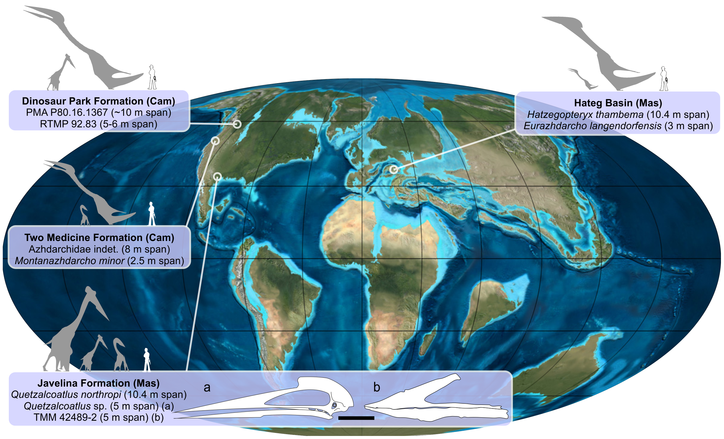
English: Map to show the global distribution of faunas containing small-medium and giant-sized azhdarchids, evidence for niche partioning. Temporal range: Late Cretaceous, 108–66 Ma |
||
| Date | |||
| Source | http://www.plosone.org/article/info%3Adoi%2F10.1371%2Fjournal.pone.0054268 | ||
| Author | Image rendering courtesy of Mark Witton; map imagery by kind permission of Ron Blakey, Colorado Plateau Geosystems, Inc. Outdated Hatzegopteryx silhouette has been replaced with newer one by Witton:[1] | ||
| Permission (Reusing this file) |
|
File history
Click on a date/time to view the file as it appeared at that time.
| Date/Time | Thumbnail | Dimensions | User | Comment | |
|---|---|---|---|---|---|
| current | 13:40, 21 January 2017 | | 2,375 × 1,441 (2.33 MB) | FunkMonk | Update Hatzegopteryx silhouette. |
| 22:58, 4 February 2013 |  | 2,375 × 1,441 (3.98 MB) | FunkMonk | {{Information |Description=Map to show the global distribution of faunas containing small-medium and giant-sized azhdarchids, evidence for niche partioning. |Date=2013 |Author=Image rendering courtesy of Mark Witton; map imagery by kind permission of R... |
File usage
The following pages on the English Wikipedia use this file (pages on other projects are not listed):
Global file usage
The following other wikis use this file:
- Usage on de.wikipedia.org
- Usage on es.wikipedia.org
- Usage on fr.wikipedia.org
- Usage on he.wikipedia.org
- Usage on hr.wikipedia.org
- Usage on id.wikipedia.org
- Usage on it.wikipedia.org
- Usage on ja.wikipedia.org
- Usage on nl.wikipedia.org
- Usage on ru.wikipedia.org
- Usage on sh.wikipedia.org
- Usage on zh.wikipedia.org
- Usage on zh.wikibooks.org