
File:Asia1899.JPG
Size of this preview: 735 × 600 pixels. Other resolutions: 294 × 240 pixels | 588 × 480 pixels | 941 × 768 pixels | 1,255 × 1,024 pixels | 2,510 × 2,048 pixels | 3,198 × 2,610 pixels.
Original file (3,198 × 2,610 pixels, file size: 3.64 MB, MIME type: image/jpeg)
| This is a file from the Wikimedia Commons. Information from its description page there is shown below. Commons is a freely licensed media file repository. You can help. |
Summary
| Description |
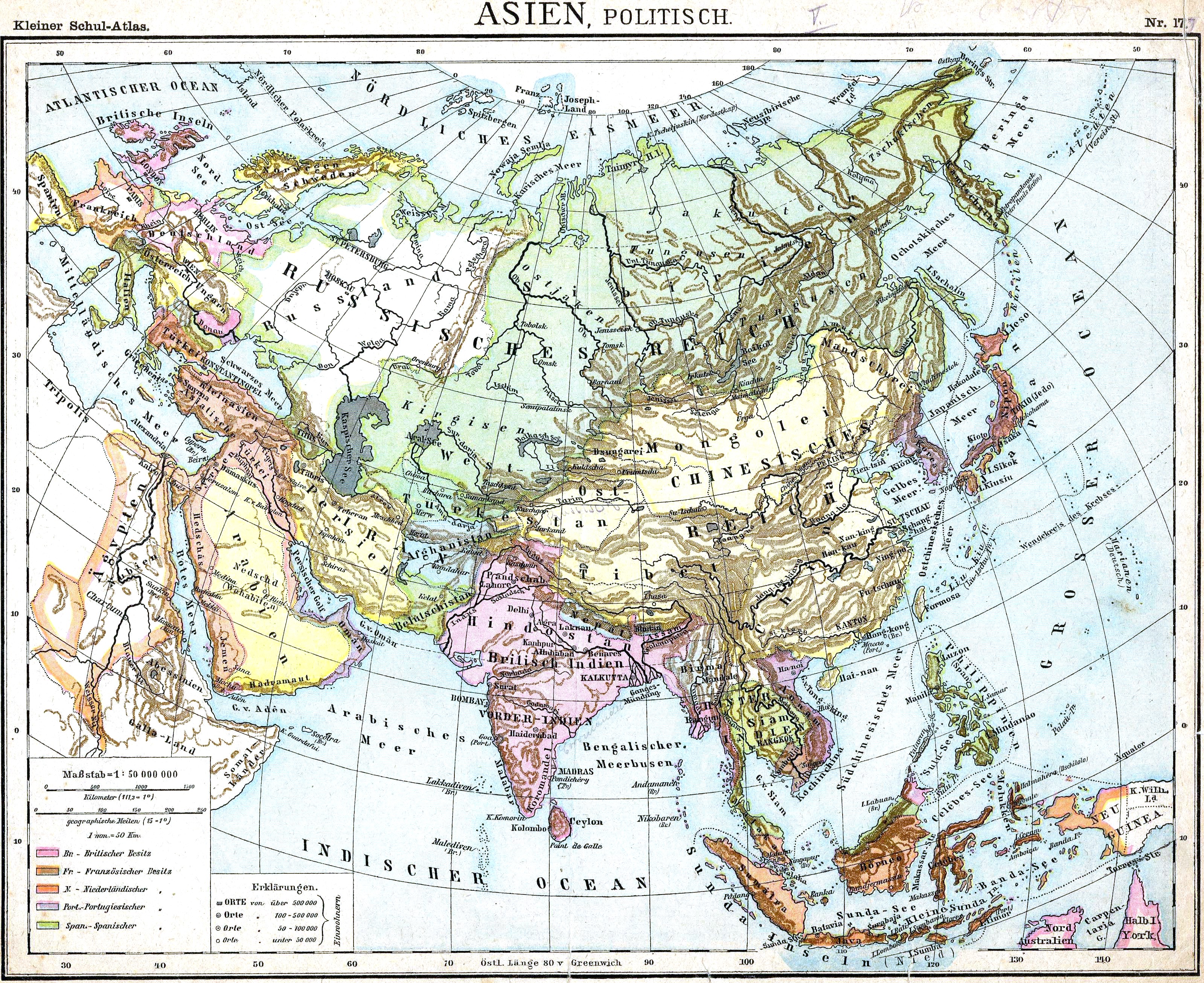
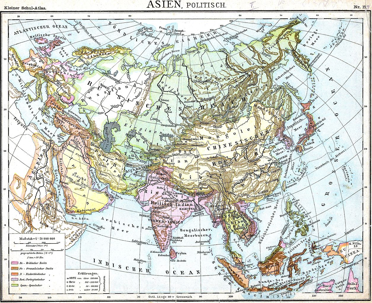
English: Political Map of Asia |
|||||||||||||||||||||||
| Date | by 1893 | |||||||||||||||||||||||
| Source | "Volksschul-Atlas", Dreihundertste Auflage, George Westermann in Braunschweig, 1899. Scan made by Olahus | |||||||||||||||||||||||
| Author |
|
|||||||||||||||||||||||
.jpg)
.JPG)
Licensing
|
This work is in the public domain in its country of origin and other countries and areas where the copyright term is the author's life plus 100 years or fewer. | |
| This file has been identified as being free of known restrictions under copyright law, including all related and neighboring rights. | |
File history
Click on a date/time to view the file as it appeared at that time.
| Date/Time | Thumbnail | Dimensions | User | Comment | |
|---|---|---|---|---|---|
| current | 19:37, 27 March 2010 | | 3,198 × 2,610 (3.64 MB) | Alex:D | Reverted to version as of 15:30, 15 November 2009 The original uploader agrees with my work |
| 15:15, 2 March 2010 |  | 3,198 × 2,610 (2.19 MB) | HéctorTabaré | Reverted to version as of 23:54, 4 February 2007 Not necessary to "whitened" the original. | |
| 15:30, 15 November 2009 |  | 3,198 × 2,610 (3.64 MB) | Alex:D | whitened | |
| 23:54, 4 February 2007 |  | 3,198 × 2,610 (2.19 MB) | Olahus | '''Description:''' Political Map of Asia. '''Source:''' D. H. Lange "Volksschul-Atlas", Dreihundertste Auflage, George Westermann in Braunschweig, 1899. '''Author:''' Scan made by Olahus '''License:''' Public Domain, because copyright |
File usage
The following pages on the English Wikipedia use this file (pages on other projects are not listed):
Global file usage
The following other wikis use this file:
- Usage on de.wikipedia.org
- Usage on fr.wikipedia.org
- Usage on ro.wikipedia.org
- Usage on zh.wikipedia.org