
File:Ashton Hall, south tower - geograph.org.uk - 1674506.jpg
No higher resolution available.
Ashton_Hall,_south_tower_-_geograph.org.uk_-_1674506.jpg (640 × 480 pixels, file size: 69 KB, MIME type: image/jpeg)
| This is a file from the Wikimedia Commons. Information from its description page there is shown below. Commons is a freely licensed media file repository. You can help. |
Summary
| Description |
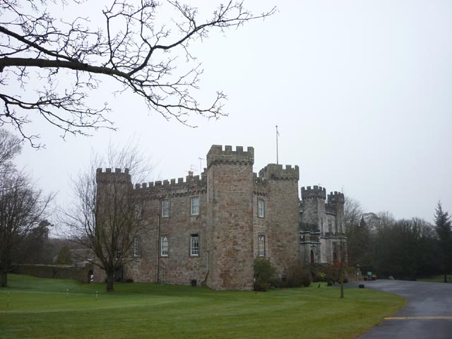
English: Ashton Hall, south tower, near to Conder Green, Lancashire, Great Britain.
The south wing of the hall is a tower house possibly of 14th century origin. Some history can be found on the Lancaster Golf Club website <a title="http://www.lancastergc.co.uk/pages.php/page/8c5d163e-2477-102b-bfae-00e08133f7d2/view_section.html" rel="nofollow" href="http://www.lancastergc.co.uk/pages.php/page/8c5d163e-2477-102b-bfae-00e08133f7d2/view_section.html">Link</a><img style="padding-left:2px;" alt="External link" title="External link - shift click to open in new window" src="http://s0.geograph.org.uk/img/external.png" width="10" height="10"/> |
| Date | |
| Source | From geograph.org.uk; transferred by User:Belovedfreak using geograph_org2commons. |
| Author | Karl and Ali |
| Permission (Reusing this file) |
Creative Commons Attribution Share-alike license 2.0 |
| Attribution (required by the license) | Karl and Ali / Ashton Hall, south tower / |
| Camera location | | View this and other nearby images on: OpenStreetMap |
|---|
| Object location | | View this and other nearby images on: OpenStreetMap |
|---|
_region:GB-GBN_heading:337.00&language=en)
Licensing

|
This image was taken from the Geograph project collection. See this photograph's page on the Geograph website for the photographer's contact details. The copyright on this image is owned by Karl and Ali and is licensed for reuse under the Creative Commons Attribution-ShareAlike 2.0 license.
|
This file is licensed under the Creative Commons Attribution-Share Alike 2.0 Generic license.
Attribution: Karl and Ali
- You are free:
- to share – to copy, distribute and transmit the work
- to remix – to adapt the work
- Under the following conditions:
- attribution – You must give appropriate credit, provide a link to the license, and indicate if changes were made. You may do so in any reasonable manner, but not in any way that suggests the licensor endorses you or your use.
- share alike – If you remix, transform, or build upon the material, you must distribute your contributions under the same or compatible license as the original.
File history
Click on a date/time to view the file as it appeared at that time.
| Date/Time | Thumbnail | Dimensions | User | Comment | |
|---|---|---|---|---|---|
| current | 20:22, 6 August 2010 | | 640 × 480 (69 KB) | File Upload Bot (Magnus Manske) | == {{int:filedesc}} == {{Information |Description={{en|1=Ashton Hall, south tower, near to Conder Green, Lancashire, Great Britain. The south wing of the hall is a tower house possibly of 14th century origin. Some history can be found on the Lancaster Gol |
File usage
The following pages on the English Wikipedia use this file (pages on other projects are not listed):
Global file usage
The following other wikis use this file:
- Usage on dag.wikipedia.org
- Usage on da.wikipedia.org
- Usage on en.wikibooks.org
- Usage on ru.wikipedia.org