
File:Arch Septimius Severus Column Phocas Forum Romanum Rome.jpg

Size of this preview: 800 × 528 pixels. Other resolutions: 320 × 211 pixels | 640 × 423 pixels | 1,024 × 676 pixels | 1,280 × 845 pixels | 2,560 × 1,690 pixels | 4,592 × 3,032 pixels.
Original file (4,592 × 3,032 pixels, file size: 14.59 MB, MIME type: image/jpeg)
| This is a file from the Wikimedia Commons. Information from its description page there is shown below. Commons is a freely licensed media file repository. You can help. |
Summary
| Description |
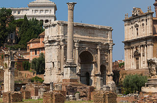
Français : L'Arc de Septime Sévère. Au premier plan, la Colonne de Phocas, en arrière-plan, le Vittoriano, à droite, la façade de l'église des Saints Lucs et Martine. Forum Romanum, Rome, Italie. |
| Date | |
| Source | Own work |
| Author | Jebulon |
| Camera location | | View this and other nearby images on: OpenStreetMap |
|---|
| This is a retouched picture, which means that it has been digitally altered from its original version. Modifications: sky details adjusted, ugly wires removed by cloning out. With GIMP.
|
Licensing
I, the copyright holder of this work, hereby publish it under the following license:
| This file is made available under the Creative Commons CC0 1.0 Universal Public Domain Dedication. | |
| The person who associated a work with this deed has dedicated the work to the public domain by waiving all of their rights to the work worldwide under copyright law, including all related and neighboring rights, to the extent allowed by law. You can copy, modify, distribute and perform the work, even for commercial purposes, all without asking permission.
|
This image has been assessed using the Quality image guidelines and is considered a Quality image.
|
File history
Click on a date/time to view the file as it appeared at that time.
| Date/Time | Thumbnail | Dimensions | User | Comment | |
|---|---|---|---|---|---|
| current | 09:48, 6 November 2013 | | 4,592 × 3,032 (14.59 MB) | Jebulon | new version |
| 10:44, 1 November 2013 |  | 4,592 × 3,032 (13.27 MB) | Jebulon | saturation, light, contrast adjusted. | |
| 16:41, 27 October 2013 |  | 4,592 × 3,032 (11.44 MB) | Jebulon | User created page with UploadWizard |
File usage
The following pages on the English Wikipedia use this file (pages on other projects are not listed):
Global file usage
The following other wikis use this file:
- Usage on lv.wikipedia.org
- Usage on pt.wikipedia.org