
File:Achemenids500BC.png

Size of this preview: 800 × 511 pixels. Other resolutions: 320 × 205 pixels | 640 × 409 pixels | 1,020 × 652 pixels.
Original file (1,020 × 652 pixels, file size: 27 KB, MIME type: image/png)
| This is a file from the Wikimedia Commons. Information from its description page there is shown below. Commons is a freely licensed media file repository. You can help. |
Summary
| Description |
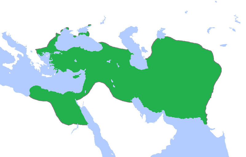
English: Locator map of the Persian Empire, c. 500 BC.
(Partially based on Atlas of World History (2007) - The World 750-500 BC, map) |
| Date | |
| Source | Own work |
| Author | Gabagool |
Licensing
I, the copyright holder of this work, hereby publish it under the following license:
This file is licensed under the Creative Commons Attribution 3.0 Unported license.
- You are free:
- to share – to copy, distribute and transmit the work
- to remix – to adapt the work
- Under the following conditions:
- attribution – You must give appropriate credit, provide a link to the license, and indicate if changes were made. You may do so in any reasonable manner, but not in any way that suggests the licensor endorses you or your use.
File history
Click on a date/time to view the file as it appeared at that time.
| Date/Time | Thumbnail | Dimensions | User | Comment | |
|---|---|---|---|---|---|
| current | 23:54, 11 June 2017 | | 1,020 × 652 (27 KB) | LouisAragon | rv sock. |
| 23:39, 11 November 2015 |  | 1,020 × 652 (20 KB) | History of Persia | look at the reference page for the wikipedia article Achaemenid Arabia. Look at the maps of Gandhara and Sogdia. | |
| 00:36, 14 October 2015 |  | 1,020 × 652 (27 KB) | LouisAragon | Constant hoax additions by HistoryofPersia. Only the addition of Macedon and those parts of Arabia were correct, the rest is all historical hoax. | |
| 23:42, 11 October 2015 |  | 1,020 × 652 (20 KB) | History of Persia | Macedonia | |
| 18:18, 23 September 2015 |  | 1,020 × 652 (20 KB) | LouisAragon | Even if it was true, we dont have a source for it. Its too much theorycrafting. | |
| 23:31, 8 September 2015 |  | 1,012 × 648 (19 KB) | History of Persia | More accurate map. info on greek territories: File:Map Greco-Persian Wars-en.svg, size of Mascat (modern Oman/UAE): File:East-Hem 600bc.jpg. clay tablets in old persian have been found in bahrain, so its likely they were part of the achaemenid empire | |
| 00:52, 29 July 2015 |  | 1,020 × 652 (20 KB) | History of Persia | They controlled arabia petrea. see the wikipedia article: achaemenid arabia. They also conquered the amyrgioi (see: Wars of darius I) | |
| 06:23, 14 February 2013 |  | 1,020 × 652 (27 KB) | TRAJAN 117 | Cropped again | |
| 06:17, 14 February 2013 |  | 1,020 × 902 (35 KB) | TRAJAN 117 | Cropped | |
| 15:50, 23 April 2009 |  | 1,481 × 902 (50 KB) | Gabagool | {{Information |Description={{en|1=Locator map of the Persian Empire, c. 500 BC. (Partially based on ''Atlas of World History'' (2007) - The World 750-500 BC, map)}} |Source=Own work by uploader |Author=Gabagool / Jarle Grøhn |Date=2009 |
File usage
The following pages on the English Wikipedia use this file (pages on other projects are not listed):
Global file usage
The following other wikis use this file:
- Usage on he.wiktionary.org
- Usage on hu.wikipedia.org
- Usage on sco.wikipedia.org