
File:AMH-4740-NA Map of Poeloe Run.jpg

Size of this preview: 800 × 590 pixels. Other resolutions: 320 × 236 pixels | 640 × 472 pixels | 1,024 × 755 pixels | 1,280 × 944 pixels | 2,400 × 1,770 pixels.
Original file (2,400 × 1,770 pixels, file size: 882 KB, MIME type: image/jpeg)
| This is a file from the Wikimedia Commons. Information from its description page there is shown below. Commons is a freely licensed media file repository. You can help. |
Summary
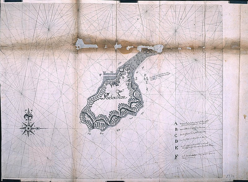
Nederlands: Plattegrond van Poeloe Run
                     English:  Map of Poeloe Run
                     Bahasa Indonesia:  Peta Pulau Ron
( |
||||||||||||||||||||||||
|---|---|---|---|---|---|---|---|---|---|---|---|---|---|---|---|---|---|---|---|---|---|---|---|---|
| Author |
Creator:Batavia 1623 kaartenmaker Nederlands: Batavia 1623 kaartenmaker (landmeter / kaartenmaker)
English: Batavia 1623 kaartenmaker (land surveyor / mapmaker) |
|||||||||||||||||||||||
| Title |
Nederlands: Plattegrond van Poeloe Run
English: Map of Poeloe Run
Bahasa Indonesia: Peta Pulau Ron |
|||||||||||||||||||||||
| Description |
Nederlands: Titel catalogus Leupe (NA): Afteeckening van 't eiland Puleron.
Notities verso: affteeckening van t'eylant Puleron / 664 c.
English: According to the Leupe catalogue (NA), the original title reads: Afteeckening van 't eiland Puleron.
Notes on reverse: affteeckening van t'eylant Puleron / 664 c.
Bahasa Indonesia: Menurut katalog Leupe (NA), judul aslinya berbunyi: Afteeckening van 't eiland Puleron.
Catatan di belakang: affteeckening van t'eylant Puleron / 664 c. |
|||||||||||||||||||||||
| Date | circa 1623 | |||||||||||||||||||||||
| Medium |
Nederlands: pen op papier
English: pen on paper
Bahasa Indonesia: pulpen di atas kertas |
|||||||||||||||||||||||
| Dimensions | height: 63 cm (24.8 in); width: 46 cm (18.1 in) | |||||||||||||||||||||||
| Collection |
|
|||||||||||||||||||||||
| Accession number |
NL-HaNA_4.VEL_1370B (old number: VEL1370B) |
|||||||||||||||||||||||
| Inscriptions |
Poelou Ron
|
|||||||||||||||||||||||
| Notes |
English: Subjects: chart / map / plan, key, building, compass / dial
Nederlands: Onderwerpen: plattegrond / kaart, legenda, gebouw, kompas / windroos
English: Post: this image is related to a VOC trading post called Run |
|||||||||||||||||||||||
| Source/Photographer |
|
|||||||||||||||||||||||
| Permission (Reusing this file) |
|
|||||||||||||||||||||||

| Object location | | View this and other nearby images on: OpenStreetMap |
|---|
File history
Click on a date/time to view the file as it appeared at that time.
| Date/Time | Thumbnail | Dimensions | User | Comment | |
|---|---|---|---|---|---|
| current | 17:11, 10 June 2014 | | 2,400 × 1,770 (882 KB) | HuskyBot | == {{int:filedesc}} == {{Artwork |title = {{nl|1=Plattegrond van Poeloe Run}} {{en|1=Map of Poeloe Run}} |description = {{nl|1=Titel catalogus Leupe (NA): ''Afteeckening van 't eiland Puleron''. Notities verso... |
File usage
The following pages on the English Wikipedia use this file (pages on other projects are not listed):
Global file usage
The following other wikis use this file:
- Usage on fr.wikipedia.org
- Usage on id.wikipedia.org
- Usage on nl.wikipedia.org