
File:1752 - WWII RAAF Radar Station 208 (former) - SHR Plan 2068 (5054690b100).jpg
Size of this preview: 424 × 600 pixels. Other resolutions: 170 × 240 pixels | 339 × 480 pixels | 707 × 1,000 pixels.
Original file (707 × 1,000 pixels, file size: 144 KB, MIME type: image/jpeg)
| This is a file from the Wikimedia Commons. Information from its description page there is shown below. Commons is a freely licensed media file repository. You can help. |
_-_SHR_Plan_2068_(5054690b100).jpg)
Summary
| 1752 - WWII RAAF Radar Station 208 (former) - SHR Plan 2068 (5054690b100) | |
|---|---|
| Photographer |
Heritage Division |
| Title |
1752 - WWII RAAF Radar Station 208 (former) - SHR Plan 2068 (5054690b100) |
| Description |
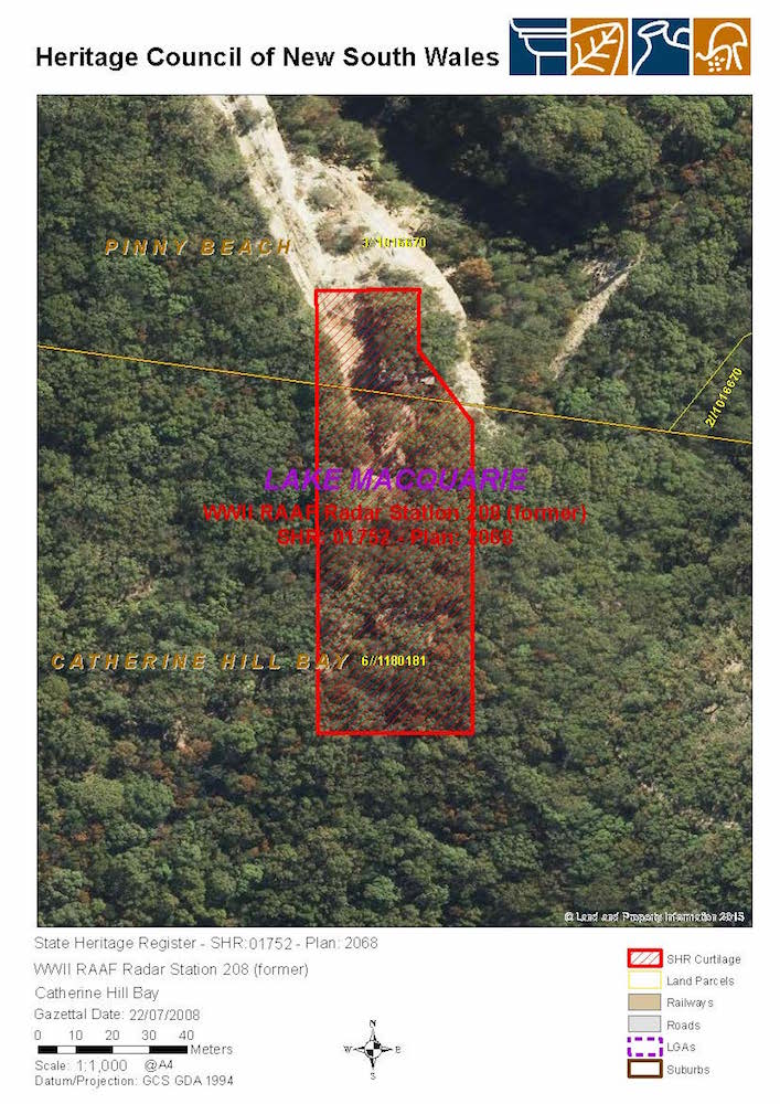
English: No. 208 Radar Station RAAF: SHR Plan 2068 |
| Depicted place | No. 208 Radar Station RAAF |
| Source | image, meta-data, Copyright State of New South Wales and Office of Environment and Heritage 2019 |
| Permission (Reusing this file) |
This file is licensed under the Creative Commons Attribution 4.0 International license.
|
Licensing
Copyright State of New South Wales and Office of Environment and Heritage 2019 archive copy at the Wayback Machine
File history
Click on a date/time to view the file as it appeared at that time.
| Date/Time | Thumbnail | Dimensions | User | Comment | |
|---|---|---|---|---|---|
| current | 07:56, 11 May 2019 | | 707 × 1,000 (144 KB) | Kerry Raymond | pattypan 18.02 |
File usage
The following pages on the English Wikipedia use this file (pages on other projects are not listed):
_-_SHR_Plan_2068_(5054690b100).jpg)