
File:1687ThoHolmeMap.jpg

Size of this preview: 800 × 584 pixels. Other resolutions: 320 × 234 pixels | 640 × 468 pixels | 1,024 × 748 pixels | 1,280 × 935 pixels | 2,560 × 1,870 pixels | 2,980 × 2,177 pixels.
Original file (2,980 × 2,177 pixels, file size: 1.36 MB, MIME type: image/jpeg)
| This is a file from the Wikimedia Commons. Information from its description page there is shown below. Commons is a freely licensed media file repository. You can help. |
Summary

|
This file has been superseded by A mapp of ye improved part of Pensilvania in America, divided into countyes townships and lotts - cropped, curves.jpg. It is recommended to use the other file. Please note that deleting superseded images requires consent.
|

|
| Description |
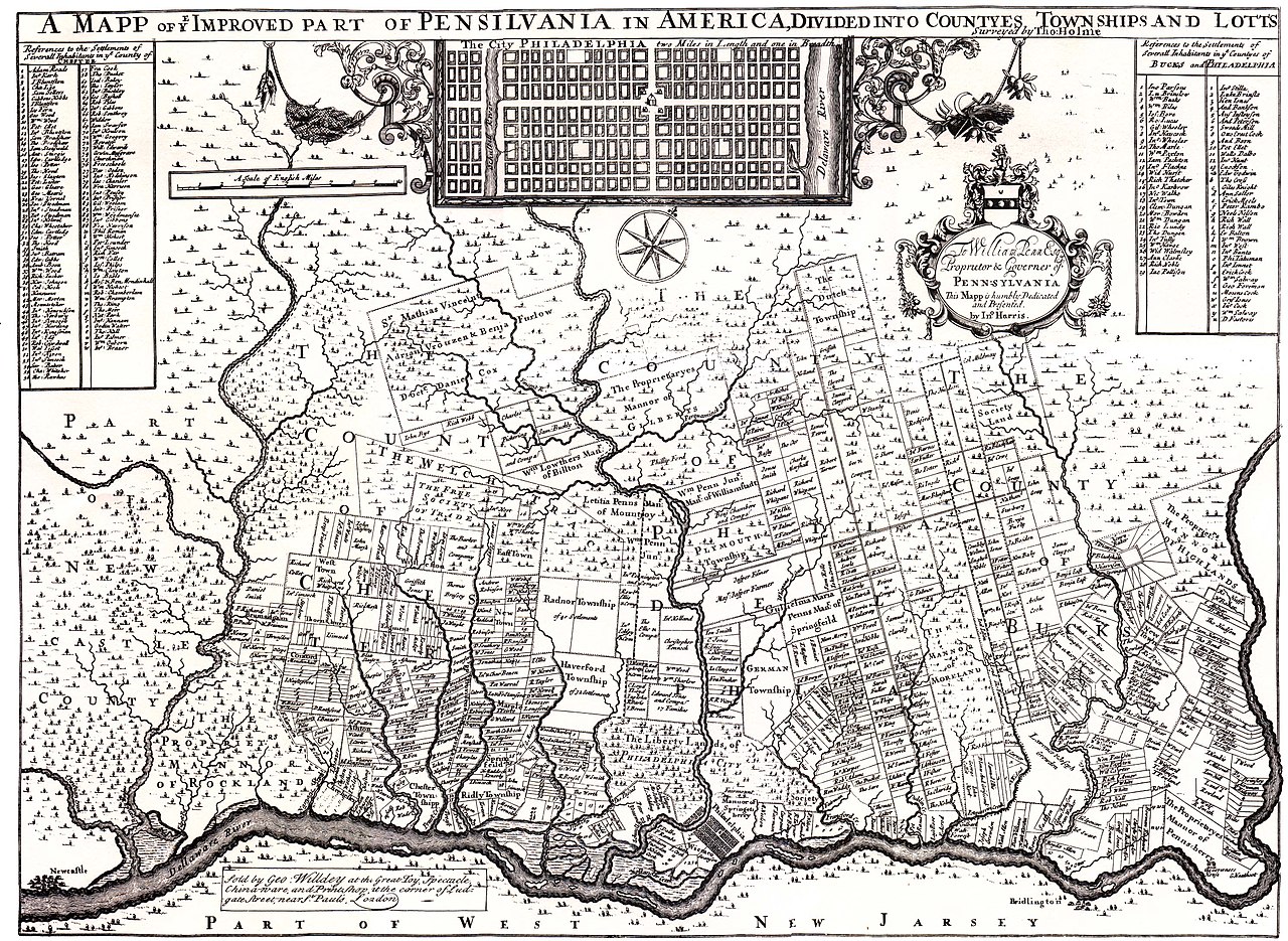
English: Map published in 1687 by en:William Penn Mapped by en:Thomas Holme from Lower Merion historical Society website |
| Date | |
| Source | Copy of map also in the Library of Congress(with copies sold by the National Park Service) |
| Author | en:William Penn & en:Thomas Holme |
Licensing
|
This is a faithful photographic reproduction of a two-dimensional, public domain work of art. The work of art itself is in the public domain for the following reason:
The official position taken by the Wikimedia Foundation is that "faithful reproductions of two-dimensional public domain works of art are public domain".
This photographic reproduction is therefore also considered to be in the public domain in the United States. In other jurisdictions, re-use of this content may be restricted; see Reuse of PD-Art photographs for details. | ||||
Original upload log
The original description page was here. All following user names refer to en.wikipedia.
| Upload date | User | Bytes | Dimensions | Comment |
|---|---|---|---|---|
| 2008-06-28 01:17:53 | Smallbones | 1430386 | 2980×2177 | Map published in 1687 by [[William Penn]] Mapped by [[Thomas Holme]] from Lower Merion historical Society website http://www.lowermerionhistory.org/atlas/1687.html copy of map also in the Library of Congress (with copies sold by the National Park Service) |
File history
Click on a date/time to view the file as it appeared at that time.
| Date/Time | Thumbnail | Dimensions | User | Comment | |
|---|---|---|---|---|---|
| current | 22:57, 7 December 2009 | | 2,980 × 2,177 (1.36 MB) | CommonsHelper2 Bot | {{BotMoveToCommons|en.wikipedia|year={{subst:CURRENTYEAR}}|month={{subst:CURRENTMONTHNAME}}|day={{subst:CURRENTDAY}}}} Map published in 1687 by en:William PennMapped by en:Thomas Holmefrom Lower Merion historical Society websitehttp://www.lowe |
File usage
No pages on the English Wikipedia use this file (pages on other projects are not listed).