
AA Highway
John Y. Brown Jr. AA Highway | |
|---|---|
| Alexandria to Augusta Highway | |
 AA Highway highlighted in red, including spurs | |
| Route information | |
| Maintained by KYTC | |
| Length | 116.285 mi[1] (187.143 km) |
| Mainline (KY 9) | |
| Length | 84.727 mi (136.355 km) |
| South end | |
| Major intersections |
|
| North end | |
| Southern Spur (KY 9) | |
| Length | 26.310 mi (42.342 km) |
| South end | |
| North end | |
| Eastern Spur (KY 10) | |
| Length | 24.628 mi (39.635 km) |
| West end | |
| East end | |
| Location | |
| Country | United States |
| State | Kentucky |
| Counties | Greenup, Carter, Lewis, Mason, Bracken, Pendleton, Campbell |
| Highway system | |
| |

The AA Highway is a 135.665-mile-long (218.332 km) state highway maintained by the Kentucky Transportation Cabinet (KYTC) in the U.S. state of Kentucky. The mainline route parallels the Ohio River from Interstate 275 (I-275) in Wilder to Vanceburg; it is cosigned as Kentucky Route (KY 9). From Vanceburg, the highway splits into two routes, with the southern spur using the KY 9 designation and continuing to Grayson and I-64, and the eastern spur using the designation of KY 10 and continuing to Greenup. The AA is mostly a two-lane rural highway that provides the only direct connection between Ashland and Northern Kentucky, which includes Cincinnati.
The route name is a contraction of its earlier name of the Alexandria to Ashland Highway, which referenced two cities connected by the highway: Alexandria in Northern Kentucky and (via I-64) Ashland in Eastern Kentucky. The route is officially known as the John Y. Brown Jr. AA Highway, named for politician and entrepreneur.[2]
While the highway passes through terrain that is rolling to hilly, the highway is generally level with moderate grades and no steep grades. Except for Carter County, all counties that the AA Highway passes through border the Ohio River. While the AA Highway is not an expressway, it nonetheless serves as the shortest highway link between Cincinnati and Ashland, Kentucky. As such, it provides a link between Cincinnati and other Midwestern cities such as Chicago, Indianapolis, and Dayton and cities south and east of Ashland such as Huntington and Charleston in West Virginia, Charlottesville and Richmond in Virginia, and Charlotte and Winston-Salem in North Carolina.[citation needed]
The only municipalities on the highway are Vanceburg and Maysville and suburban areas of Cincinnati at its western terminus. Those areas are also the only areas with any services used by motorists such as motels, gas stations, restaurants, convenience stores, etc. The only traffic signals on the AA Highway are near Maysville (along a commercial strip with many retail establishments and restaurants), suburban Cincinnati, and at its eastern terminus just north of Interstate 64 near Grayson. There are no rest areas on the AA Highway. Other than the portions that traverse the edge of Maysville and enter suburban Cincinnati, there are no shopping centers or major retail stores along the AA Highway.[citation needed]
The AA Highway is a rural two-lane highway for most of its length and traverses through some desolate terrain.[3] Driver inattention and speeding, in combination with the numerous side road entrances and at-grade intersections have made it a dangerous and deadly road. To address these issues, guide signs comparable to interstate-styled signs have been installed along the highway at major intersections, along with additional overhead lighting. Other measures to improve safety and increase capacity are under consideration.[citation needed]
Route description[edit]
The AA Highway follows a general northwest–southeast orientation. It begins at an interchange with I-275 in Wilder in Campbell County and is designated as KY 9–AA Highway. The route then passes the outskirts of its namesake Alexandria. Within Campbell County, the road is a four-lane arterial highway. Note that the KY 9 route begins about five miles (8.0 km) north in Newport before it is designated as the AA.
The next segment passes through a remote, hilly region where the road is generally three lanes, with a passing lane present at uphill grades.
A few miles west of Maysville, the highway runs concurrently with KY 10, and the road becomes an arterial highway again. The concurrency ends within Maysville, and upon passing out of the city, the road becomes a two-lane rural highway through an agricultural region.
KY 9 then crosses the Allegheny Escarpment into the Appalachian Mountains at the same time that another concurrency with KY 10 begins. The remainder of KY 9 passes through mountainous terrain and is generally two lanes with periodic passing lanes. After passing through Vanceburg, the AA Highway follows two routes. The first follows KY 9, which turns southeasterly away from the Ohio River and towards Grayson. The KY 9-AA Highway ends at an intersection with KY 1 and KY 7, which provides a short connection to I-64 and access to Ashland.
The second route follows KY 10, which continues to parallel the Ohio River. The AA Highway designation of KY 10 terminates at US Route 23 (US 23), which provides connections to Greenup and Ashland. The KY 10 route continues without the AA designation for about 1.2 miles (1.9 km) before terminating at the Ohio border on the Jesse Stuart Memorial Bridge.
History[edit]
The AA Highway was envisioned as a modern highway from Alexandria to Ashland.[4]
Construction began in 1985 on the first segment of the AA Highway.[4] Estimated to cost $266 million (equivalent to $640 million in 2023[5]) to complete, it was designed primarily as a two-lane controlled-access facility. The first phase included the construction of 86 miles (138 km) of the AA Highway from the junction of I-275 and Licking Pike (existing KY 9) in Campbell County east to Vanceburg. The first phase also included the design of two 25-mile-long (40 km) spurs running east from Vanceburg, one ending at US 23 near Lloyd and the Jesse Stuart Memorial Bridge, the other ending near I-64 in Grayson.[citation needed]
When construction began, the costs for the first phase had risen to $292.7 million;[4] the state had sold $300 million in bonds to pay for it. Segments of the highway, from Clarksburg just west of Vanceburg to Tollesboro was routed on an earlier relocated alignment of KY 10.[citation needed]
It officially opened in 1995; however, it was not formally dedicated until 2003.[citation needed]
-
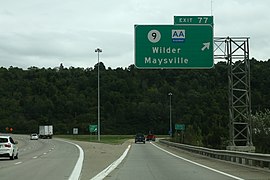 Signage for exit 77 on I-275; northern terminus of AA Highway
 -
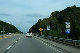 AA Highway in Cold Spring
 -
 AA Highway in Maysville
 -
 Aerial view of the AA Highway southern spur in Grayson County
.jpg)
.jpg)

.jpg)
Numbering changes[edit]
The AA Highway including the Greenup spur was originally designated as KY 546, and the Grayson spur was signed as KY 694. On May 26, 1988, the designation, "AA Highway", was proposed to be signed along with KY 546 and KY 694. A few years later, this designation was put in place with the AA Highway being co-signed with KY 546 and KY 694, however, many motorists were soon confused by the ever-changing designations.
To solve this issue, the AA Highway was renumbered in late 1995. The AA Highway including the Grayson spur was renumbered KY 9, and the Greenup spur was renumbered as KY 10. KY 10 also overlaps portions of the AA Highway throughout the entire highway's existence. Old KY 9 in Campbell County was renumbered as KY 915, and old KY 10 between Vanceburg and South Portsmouth was redesignated as KY 8.
Major intersections[edit]
Mainline AA Highway[edit]
| County | Location | mi | km | Destinations | Notes |
|---|---|---|---|---|---|
| Lewis | | 26.310 | 42.342 | Southern terminus of AA Highway mainline; AA Highway continues as southern spur designated KY 9 and eastern spur designated KY 10 | |
| | 27.265 | 43.879 | Northern end of KY 1149 concurrency | ||
| Vanceburg | 29.467 | 47.423 | |||
| | 31.011 | 49.907 | Southern terminus of KY 2523 | ||
| Clarksburg | 32.827 | 52.830 | Southern terminus of KY 3037 | ||
| Charters | 36.815 | 59.248 | Northern terminus of KY 989 | ||
| Ribolt | 42.518 | 68.426 | Northern end of KY 10 concurrency | ||
| | 46.642 | 75.063 | |||
| Mason | | 49.685 | 79.960 | Southern end of KY 1234 concurrency | |
| | 50.078 | 80.593 | |||
| | 50.222 | 80.824 | Northern end of KY 1234 concurrency | ||
| | 50.979 | 82.043 | Southern terminus of KY 3161 | ||
| | 53.261 | 85.715 | |||
| | 55.955 | 90.051 | |||
| | 56.832 | 91.462 | Southern end of KY 1448 concurrency | ||
| Maysville | 57.040 | 91.797 | Northern end of KY 1448 concurrency | ||
| 58.451 | 94.068 | ||||
| 59.736 | 96.136 | Southern end of KY 10 concurrency | |||
| 61.875 | 99.578 | Interchange | |||
| | 65.378 | 105.216 | Western terminus of KY 3056 | ||
| | 65.606 | 105.583 | Northern end of KY 10 concurrency | ||
| | 66.545 | 107.094 | |||
| Bracken | | 72.799 | 117.159 | ||
| | 74.567 | 120.004 | |||
| | 76.772 | 123.553 | |||
| Woolcott | 79.280 | 127.589 | |||
| | 82.606 | 132.941 | |||
| | 85.877 | 138.206 | |||
| | 87.830 | 141.349 | Western terminus of KY 2228 | ||
| Pendleton | | 89.174 | 143.512 | Northern terminus of KY 159 | |
| | 91.711 | 147.595 | |||
| Campbell | | 93.717 | 150.823 | Western terminus of KY 2828 | |
| Flagg Spring | 94.941 | 152.793 | |||
| | 99.316 | 159.834 | |||
| | 101.238 | 162.927 | |||
| | 103.405 | 166.414 | Interchange | ||
| | 105.348 | 169.541 | |||
| Cold Spring | 107.148 | 172.438 | Interchange (exit 14) | ||
| 109.337 | 175.961 | Northern terminus of KY 915 | |||
| Wilder | 109.755 | 176.634 | Western terminus of KY 1998 | ||
| 111.037 | 178.697 | I-275 exit 77; northern terminus of AA Highway; KY 9 continues north into Newport | |||
1.000 mi = 1.609 km; 1.000 km = 0.621 mi
| |||||
Southern spur (KY 9 to I-64)[edit]
| County | Location | mi | km | Destinations | Notes |
|---|---|---|---|---|---|
| Carter | | 0.000 | 0.000 | Southern terminus of KY 9 and southern spur of AA Highway | |
| | 1.078 | 1.735 | |||
| | 5.486 | 8.829 | Southern end of KY 7 concurrency | ||
| | 6.498 | 10.458 | Northern end of KY 7 concurrency | ||
| | 11.324 | 18.224 | |||
| | 12.821 | 20.633 | Northern terminus of KY 1773 | ||
| Lewis | | 22.690 | 36.516 | Southern end of KY 1149 concurrency | |
| | 22.899 | 36.852 | Western terminus of KY 1306 | ||
| | 26.310 | 42.342 | Northern terminus of AA Highway southern spur; Mainline AA Highway continues north on KY 9; AA Highway eastern spur continues east on KY 10 | ||
1.000 mi = 1.609 km; 1.000 km = 0.621 mi
| |||||
Eastern spur (KY 10)[edit]
| County | Location | mi | km | Destinations | Notes |
|---|---|---|---|---|---|
| Lewis | | 91.581 | 147.385 | Western terminus of AA Highway eastern spur; Mainline AA Highway continues north on KY 9; AA Highway southern spur continues south on KY 9 | |
| | 93.473 | 150.430 | Eastern terminus of KY 3020 | ||
| | 96.879 | 155.912 | |||
| | 99.158 | 159.579 | |||
| | 99.985 | 160.910 | |||
| | 102.191 | 164.460 | |||
| Greenup | | 105.178 | 169.268 | ||
| | 108.181 | 174.100 | Western end of KY 784 concurrency | ||
| Letitia | 108.502 | 174.617 | Eastern end of KY 784 concurrency | ||
| | 112.916 | 181.721 | |||
| | 116.209 | 187.020 | Terminus of AA highway eastern spur; KY 10 continues east to the Ohio River | ||
1.000 mi = 1.609 km; 1.000 km = 0.621 mi
| |||||
See also[edit]
References[edit]
- ^ Division of Planning. "Official Milepoint Route Log Extract". Highway Information System. Kentucky Transportation Cabinet. Retrieved July 2, 2013.
- ^ Flynn, Terry (November 27, 1993). "AA Highway filling a gap". The Cincinnati Enquirer. p. 13. Retrieved May 29, 2023.
- ^ Division of Planning (2004). "Possible KY 9 Improvements". Kentucky Transportation Cabinet. Archived from the original on August 4, 2004.
- ^ a b c Davis, Merlene (January 27, 1985). "Several Projects Helping to Ease Area's Traffic Woes". Herald-Leader. Lexington, Kentucky.
- ^ Johnston, Louis; Williamson, Samuel H. (2023). "What Was the U.S. GDP Then?". MeasuringWorth. Retrieved November 30, 2023. United States Gross Domestic Product deflator figures follow the MeasuringWorth series.
- State highways in Kentucky
- Transportation in Lewis County, Kentucky
- Transportation in Mason County, Kentucky
- Transportation in Bracken County, Kentucky
- Transportation in Pendleton County, Kentucky
- Transportation in Campbell County, Kentucky
- Transportation in Carter County, Kentucky
- Transportation in Greenup County, Kentucky